|
Trail Guides
|
Peaslee Wildlife Management Area
|
8
 
|
CR 644/Hesstown Road, Cumberland, NJ
Phone: (609) 984-0547
www.state.nj.us/dep/fgw/wmas.htm
NJ Department of Environmental Protection
Turn Left out of Cumberland Pond onto Route 49. Follow for 1.1 miles to Hesstown Rd. There will be a small brown sign at the turn directing you to Peaslee WMA. Continue down Hesstown Rd. for 1.8 miles and turn Left at the signage into Peaslee WMA. Map
 |
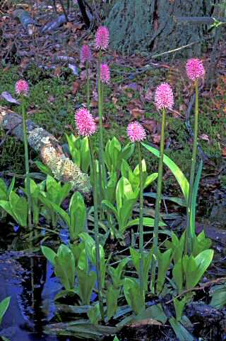
| Swamp Pink | Bill Garwood |
| |
| | At over 25,000-acres, Peaslee Wildlife Management Area is the second largest WMA in the state of New Jersey. Due to its size and the limitations of this guide, we can only direct you to a few of the WMA’s access points. We recommend downloading the topographical maps on the New Jersey Department of Environmental Protection website at
www.njfishandwildlife.com/wmaland.htm and taking the time to explore the site on your own. Numerous sand and gravel roads traverse the area, and although you may feel lost from time to time, you will soon find your way back to a paved road. For a shorter visit, stick to the paved roads and pull off to scan the forest or any one of numerous sunny openings. Peaslee is the
southern-most example of true pine barrens
forest with a predominance of pine-oak
woodland. However, there are also pockets of
different vegetation such as maple-gum swamp and other forested wetlands; and sedge
meadows and cultivated fields that have been planted for wildlife. The variety of habitats attracts an unusually large variety of species. Peaslee is bordered by the Tuckahoe River to the east and the Manumuskin River to the west.
the influx of breeding and migrating passerines in spring. The access points along Route 49 and CR 644 are some of the best spots in the region for warblers, tanagers and vireos.
Winter is a wonderful time to drive the many sand and gravel roads in Peaslee. Try the
7-mile auto-trail loop that begins and ends on Hesstown Rd. Listen closely for the calls of owls while visiting in winter—you may be able to hear them calling to each other as they begin and carry on their courtship.
Spring is the premier season for Peaslee with the breeding and migrating passerines
as well as a great diversity of butterflies and dragonflies.
Even for the most advanced paddler, canoeing or kayaking the lower Tuckahoe River can be quite challenging, but very rewarding as a wide variety of wildflowers are in bloom along the route. Large stands of cardinal flower, pickeral weed, turks cap lilies and white and bullhead waterlilies may be observed up close. Fishing is quite popular this time of year. Bicycling along the peaceful, and reasonably flat, roads and trails is also a favorite activity.
Take precautions against chiggers and ticks as you explore Peaslee. Outdoor activities such as canoeing, kayaking, hiking and bicycling are still quite enjoyable, and as the leaves begin to fall you may have a much better chance of
seeing a red fox or either Barred Owl and
northern pine snake, both of which are on
New Jersey’s threatened list.
|
|
|