666 Back Neck Road, Fairton, NJ 08320
Phone: (888) 627-7437
www.pseg.com/environment/estuary
Public Service Enterprise Group (PSEG)
Turn around, return to Tindall Island Rd. and turn Right. After a quarter mile, turn Left onto CR 642/Bacons Neck Rd., and continue for approximately 1.6 miles to the intersection with CR 623/Ye Greate St. Turn Right onto CR 623
and after 0.3 miles turn Left onto CR 607/ Bridgeton Rd. For those interested in
Revolutionary War history, a 5-minute detour
will take you to the monument honoring the Cumberland County patriots who burned British tea here in Greenwich in 1774. To reach the site, continue on CR 623 beyond the Bridgeton Rd. intersection. The monument is on the Right, approximately a hundred yards beyond. After
visiting the site return to Bridgeton Rd. intersection and turn Right. Follow Bridgeton Rd.
for approximately 1.9 miles to CR 650/Sheppards Mill Rd. Turn Right, follow CR 650 approximately 3.9 miles to CR 650/Dutch Neck Rd. Turn Left
and follow CR 650 into Bridgeton where it becomes Fayette St. At the intersection with Route 49, turn Right, proceed over the bridge
and turn Right onto CR 609/Bridgeton-Fairton Rd. After 3.1 miles, turn Right at the T as CR 609 turns into CR 553. After 1⁄2 mile, turn Right onto CR 601/Back Neck Rd. Follow to 666 Back Neck Rd. and turn Right into parking area. Map
 |
| Hansey Creek | Bill Garwood |
| |
| | The Green Swamp Area, part of PSEG’s Estuary Enhancement Program, is approximately 530 acres in size. Located on the shores of the Cohansey River at the top of one of several sharp bends in the river’s course, this site offers visitors a range of wildlife viewing opportunities. A well-marked trail with interpretive signs, beginning at the parking lot, leads visitors through field edge, forest and salt marsh habitats where they can learn about the area’s flora and fauna. A public boat launch, located at the end of a gravel road approximately 200 yards beyond the parking lot, gives visitors a great view of the river and
provides easy access for paddlers.
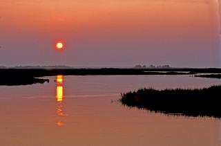
The boat launch is the place to be. If you have a canvas camper’s chair, bring it along. With a little patience you’re likely to see a soaring Bald Eagle. Great Blue Heron are still here and although the weather can be bitterly cold, the view is nothing short of spectacular, especially when the area is covered with a light snowfall. Scan the river for wintering waterfowl and
secretive river otter.
Southern migrants arrive and may be found flitting through the fields and forest at this site. Some are just stopping by while others are here to stay through the summer. Look for Indigo Bunting, Blue Grosbeak and American Goldfinch along the field edges. Northern Cardinal, Northern Mockingbird, Carolina Chickadee, Carolina Wren, Wood Thrush and White-breasted Nuthatch are some of the many summer residents that nest in the forest here. Osprey arrive in March to begin building and/or repairing nests for their summer stay. The wetlands are active as herons, egrets and Clapper Rail search for food at the shoreline, alongside mammals, reptiles and insects of the marshland.
Wildflowers are in bloom in the fields and forest and deer, fox, raccoon, muskrat, rabbit, squirrel and skunk are active. On some days, hot weather and high humidity can make the river’s edge uncomfortable for visitors, but the possible rewards in wildlife viewing make it a small price to pay. As at all times of the year at this site, a trip to the boat launch to scan for Bald Eagle is worth at least a half an hour of effort.
This is changeover time. As the trees turn from green to gold to red, bird migration is in full swing. Various wood warblers and other passerines stop here on their way south. Some of the summer nesters, such as the Osprey, prepare to leave;
others such as Northern Cardinal and Carolina Wren stay through the winter. Migrating raptors, such as Sharp-shinned, Cooper’s and Red-tailed Hawks, and falcons, may be seen overhead. Along the Bayshore, raptors move both north and south, either heading directly south toward Cape May Point, or turning northwest to find a shorter crossing of the Delaware Bay.
|