


Coastal Impoundment Vulnerability and Resilience Project
The Coastal Impoundment Vulnerability and Resilience Project (CIVRP), funded by the Department of the Interior via the National Fish and Wildlife Foundation, aims to map and catalog all state, federal, and privately owned coastal impoundments from Virginia to Maine. In addition, we are compiling information on the ecological and societal services provided by these sites and assessing their vulnerability to sea level rise. We will develop a ranking of impoundments based on metrics related to their ecological value, importance to human populations, and potential for maintaining their structural integrity. The project is a cooperative effort of a diverse team of partners including researchers from New Jersey Audubon, National Wildlife Federation, Conservation Management Institute (Virginia Tech), Princeton Hydro, and the US Fish and Wildlife Service.
Impoundment Map
Impoundment Sites

Site Description
State: Delaware
County: Sussex
Ownership: State
Impoundments
35 Acre Pond: 53 acres
65 Acre Pond: 76 acres
Goose Pond: 73 acres
Muddy Creek: 33 acres
Mulberry Pond: 80 acres
Zigzag Marsh: 27 acres
Ecology and Management
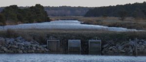
Assawoman Wildlife Area in Bethany Beach, DE contains six impoundments covering over 300 acres. The impoundments host robust numbers of waterfowl including Wigeon, Gadwall, Buffleheads and Snow Geese during the winter. The Delaware Division of Fish and Wildlife does mid-winter waterfowl flights and has a Christmas Bird Count.
The impoundments are all managed to provide habitat for wintering and migratory waterfowl, but with management regimes specific to each impoundment. Water levels are kept relatively stable to promote wigeongrass production in the 65-Acre, 35-Acre, Mulberry, and Zigzag Marsh Ponds.
Vulnerability
The impoundments border the little Assawoman Bay, one of Delaware’s inland bays, and are thus subject to wave energy and tidal forces. The impoundments have experienced some overtopping and saltwater intrusion during hurricanes, including Hurricane Sandy.
Human Value
There are no visitor use surveys at Assawoman WMA, but the site does host campers from Camp Barnes, a Delaware State Police sponsored free summer camp for kids between 10 – 13 years of age.
Literature Resources
Below is a list of articles describing research occurring at or near the impoundments:
Chamberlain, E. B. A survey of the marshes of Delaware. Dover, Delaware: The State of Delaware, Board of Game and Fish Commissioners; 1951.
Chan, S., and S. Shulte. A Plan for Monitoring Shorebirds During the Non-breeding Season in Bird Monitoring Region Delaware – BCR 30. Manomet, Massachusetts: Manomet Center for Conservation Sciences; 2003.
Coxe, R. Historical analysis and map of vegetation communities, land covers, and habitats of Assawoman Wildlife Area, Sussex County, Delaware. Smyrna, Delaware: Delaware Division of Fish and Wildlife, Natural Heritage and Endangered Species Program; 2012. 289 p.
Florschutz, O. Mosquito production and wildlife usage in natural, ditched, and impounded tidal marshes on Assawoman Wildlife Area, Delaware. University of Delaware; 1959.
Gano Jr., R. D. Assawoman Wildlife Area Management Plan. Dover, Delaware: Delaware Division of Fish and Wildlife; 1996.
Gano Jr., R. D. 1991. Assawoman Wildlife Area: a description of its history and present use. Pages 27-28 In Ullman, W., editor. A day in the life of Delaware’s forgotten bay: a scientific survey of Little Assawoman Bay, Delaware Department of Natural Resources and Environmental Control, Dover, Delaware.

Site Description
State: Virginia
County: Virginia Beach
Ownership: Federal
Impoundments
A-pool: 181 acres
B-pool: 127 acres
C-pool: 178 acres
D-pool North: 2 acres
D-pool South: 9 acres
E-pool: 14 acres
G-pool: 78 acres
H-pool: 50 acres
J-pool: 89 acres
C-storage pool: 49 acres
B-storage pool: 13 acres
False Cape East: 92 acres
False Cape West: 94 acres
Frank Carter group: 25 acres
Ecology and Management
Back Bay NWR was established in 1938, and like many Refuges its primary management goal is focused on migratory and wintering waterfowl and shorebirds. The Refuge works to provide quality habitat that maintains or increases existing levels of migratory waterfowl and shorebird use. Sixteen impoundments occur on the refuge including five in the separate “Frank Carter” group. Two additional impoundments occur on the adjacent False Cape State Park, but are managed by Back Bay NWR staff. The impoundments are oligohaline (almost fresh water) and most are surrounded by a network of dirt roads atop their dikes.
Sixteen impoundments occur on the Refuge and provide quality habitat that maintains or increases existing levels of migratory waterfowl and shorebird use.

These management impoundments at Back Bay support a broad array of bird species. Specifically, the impoundments provide habitat for over 30 waterfowl species. Wading bird populations vary with the season. Most species are present only during their migrations and throughout the summer. Impoundment water levels are drawn down during July to provide additional fish and amphibian forage for these birds, particularly young of the year, prior to their migrations. Refuge shorebirds include the sandpipers, plovers, dunlins, knots, yellowlegs, dowitchers, and sanderlings, among others. They utilize the wet mud/sand flats and beach tidal habitats, where they search for the high-protein invertebrate foods they need to sustain them during their exhausting migrations. They use the Back Bay Refuge beach and impoundments vicinities most during their spring and fall migrations. The Refuge draws down the water levels of its 1000-acre impoundment complex to provide them with additional feeding areas during those periods. The secretive group of saltmarsh birds present on the impoundments includes the rails, gallinules, moorhens and coots, among others. King rail and American coot are most commonly heard or seen on bird surveys.
The habitats provided by the impoundments also support many other species, including a diverse and healthy fish community; river otters; and two state rare beetles and two rare moths. The impoundments at Back Bay NWR also support federal threatened (FT) and endangered (FE) species. These include the piping plover (FT), Kemps ridley (FE), loggerhead sea turtle (FT), green sea turtle (FT), leatherback sea turtle (FE), and seabeach amaranth (FT). However, in terms of sea turtles, those that nest here are the loggerheads. Several Kemp’s ridley have been seen since 2012, and occasionally there are green sea turtle. The state endangered eastern big-eared bat is suspected to use Back Bay NWR, but its occurrence has not been confirmed. The State threatened glass lizard was documented on Back Bay NWR during the late 1990s, and the most recent siting was in 2010. The state endangered Eastern tiger salamander is also present on the Refuge.
Several non-native and or invasive species threaten management of the impoundments. The feral hog, feral horse, nutria and resident Canada goose all consume moist soil vegetation that is grown each year in the impoundment complex to feed wintering and migrating waterfowl. If too much browsing on this important resource is allowed to occur, the ability of the Refuge to provide wintering waterfowl foods will be severely reduced. Feral hogs also significantly impact dike slopes and public use areas with their rooting behavior as they seek tubers and other foods below the surface of the ground. Such turned-over ground contributes to soil erosion around dike slopes, and creates a public safety hazard, while also removing the food-plants/vegetative cover.
In terms of management, water levels in the impoundments are drawn down during the spring and early fall months to create shallow mud flats for the shorebird migration. This is during months of late April – May and late August – September. During the summer (July, August) pools are managed for wading/marsh birds are emergent marsh with shallow water and patches of emergent plants.
Vulnerability
The Refuge has over 8 miles of dike roads, which form 18 wetland impoundments managed by over 25 water control structures and two pump stations. Two additional impoundments (managed by the refuge) occur in the adjacent False Cape State Park. The impoundments, however, are relatively protected by the Refuge’s barrier dune system.
Human Value
The Refuge sees approximately 100,000 to 120,000 visitors per year. The Refuge also provides some education opportunities. The trail system around the Refuge headquarters; an outdoor classroom; pond activity pier; and the oceanfront, bay, and impoundment areas all serve as environmental education resources for individuals and groups. A number of self-guided interpretive kiosks and panels are strategically located throughout the Refuge, with the highest concentration in the Refuge headquarters area.
Acknowledgements
We are grateful to Geralyn Mireles, USFWS Back Bay National Wildlife Refuge, for providing helpful information used on this page.
Literature Resources
Below is a list of articles describing research occurring at or near the impoundments:
Anderson, J. T. 2006. Evaluating competing models for predicting seed mass of Walter’s millet. Wildlife Society Bulletin 34:156-158.
Brandwein, J. Back Bay National Wildlife Refuge Comprehensive Conservation Plan. Washington, D. C.: U. S. Fish and Wildlife Service; 2010.
Brinkley, E. S., and J. B. Patteson. 2001. Yellow-legged gull (Larus cachinnans cf. michahellis) at Back Bay National Wildlife Refuge, Virginia Beach. Raven 72:66-75.
Green, A., J. Lyons, M. Runge, W. Kendall, H. Laskowski, S. Lor, and S. Guiteras. Timing of impoundment drawdowns and impact on waterbird, invertebrate, and vegetation communities within managed wetlands, Study manual – Final version field season 2007. Laurel, Maryland: USGS Patuxent Wildlife Research Center; 2007.
Green, A. W., W. L. Kendall, H. P. Laskowski, J. E. Lyons, L. Socheata, and M. C. Runge. Draft version of the USFWS R3/R5 Regional Impoundment Study. Washington, D. C.: U. S. Fish and Wildlife Service; 2008.
IWMM [Integrated Waterbird Management and Monitoring Project]. Project Update – October 2010. http://iwmmprogram.ning.com/: Integrated Waterbird Management and Monitoring Project; 2010.
McLeod, G. M., J. Daigneau, and R. J. Gucwa. 2005. Supervised classification of landsat-7 imagery for the detection of Phragmites australis in Back Bay National Wildlife Refuge. Journal of the North Carolina Academy of Science 121:61-70.
Pease, M. L., R. K. Rose, and M. J. Butler. 2005. Effects of human disturbances on the behavior of wintering ducks. Wildlife Society Bulletin 33:103-112.
Rogers, S. L., J. A. Collazo, and C. A. Drew. 2013. King Rail (Rallus elegans) occupancy and abundance in fire managed coastal marshes in North Carolina and Virginia. Waterbirds 36:179-188.
Schulte, S., and S. Chan. A Plan for Monitoring Shorebirds During the Non-breeding Season in Bird Monitoring Region Virginia – BCR 30 and 27.
Manomet, Massachusetts: Manomet Center for Conservation Science; 2008.
Sherfy, M. H. Nutritional value and management of waterfowl and shorebird foods in Atlantic coastal moist-soil impoundments. Virginia Polytechnic Institute and State University; 1999.
Sherfy, M. H., and R. L. Kirkpatrick. 1999. Additional regression equations for predicting seed yield of moist-soil plants. Wetlands 19:709-714.
Stone, L. F. Practicing conservation biology at Back Bay National Wildlife Refuge. Ohio: Miami University; 2014.
Weldon, A. Important bird areas (IBAs) in the commonwealth of Virginia. Virginia: National Audubon Society; 2007.

Site Description
State: Maryland
County: Dorchester
Ownership: Federal
Impoundments
13 impoundments: 351 total acres
Ecology and Management

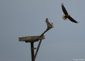
Blackwater National Wildlife Refuge has the largest breeding population of American Bald Eagles north of Florida. Photo by Alan Cressler.
The thirteen impoundments within the Blackwater National Wildlife Refuge are renowned for their abundance and diversity of waterfowl and wading bird species. Additionally, Blackwater National Wildlife Refuge is home to the largest breeding population of American Bald Eagles north of Florida and has been named a Wetland of International Importance. Observations by refuge staff and ornithologists have identified 281 bird species that regularly use the entire refuge complex. Along Wildlife Drive, which forms the bayside barrier for many of the impoundments, 242 bird species have been reported to eBird.org, including impressive high counts of and waterfowl. For example, highs of 15,000 Canada Geese; 12,000 Snow Geese; 1,150 Tundra Swans and 692 Common Merganser were seen from Wildlife Drive since 2010. The Friends of Blackwater National Wildlife Refuge report that upwards of 35,000 geese and 15,000 ducks can be seen during the November migration. Waterbird use of the impoundments is monitored through the Integrated Waterbird Management and Monitoring Program (IWMM).
The impoundments are subject to moist soil management. Pool drawdowns typically occur between mid-March and early June, depending on the wildlife objectives and moist soil plant/invertebrate response desired. Drawdown is initiated in most pools first by gravity flow, but pumping is often required in most of the impoundments to remove all the water. Several permanent and seasonal pumping stations, utilizing gasoline, diesel, and electric pumps, are operated and maintained. Rates of drawdown are critical, and, depending on the pool bottom topography and soil type or organic content, can occur rapidly or must be prolonged. All drawdowns are completed by mid-June, and pool bottoms are maintained as moist as weather conditions will allow to facilitate the germination, growth, and production of a wide diversity of emergent moist soil plants.
Vulnerability
The impoundments at Blackwater National Wildlife Refuge are sheltered by around 9,000 acres of brackish marsh. However, between 1938 and 2006 marsh was lost at a rate of 74 acres per year (Lerner et al. 2013). As this rate increases with the rate of sea-level rise over the next century the habitat within the impoundments will become increasingly valuable to birds which use the refuge. Despite their proximity to open water, the impoundments have not historical records of damage.
Human Value
Blackwater NWR received 82,163 visitors in 2011. The refuge also hosts a Youth Conservation Corps program in the summer, as well as providing educational opportunities to 1,700 students and scouts on an annual basis. Despite its rural location Blackwater NWR is one of the most popular birding locations in the state of Maryland.
Literature Resources
Below is a list of articles describing research occurring at or near the impoundments:
Beyer, W. N., D. Day, A. Morton, and Y. Pachepsky. 1998. Relation of lead exposure to sediment ingestion in mute swans on the Chesapeake Bay, USA. Environmental toxicology and chemistry 17:2298-2301.
Carowan, G. A. Chesapeake Marshlands National Wildlife Refuge Complex Comprehensive Conservation Plan. Washington, D. C.: U. S. Fish and Wildlife Service; 2006.
Green, A., J. Lyons, M. Runge, W. Kendall, H. Laskowski, S. Lor, and S. Guiteras. Timing of impoundment drawdowns and impact on waterbird, invertebrate, and vegetation communities within managed wetlands, Study manual – Final version field season 2007. Laurel, Maryland: USGS Patuxent Wildlife Research Center; 2007.
Green, A. W., W. L. Kendall, H. P. Laskowski, J. E. Lyons, L. Socheata, and M. C. Runge. Draft version of the USFWS R3/R5 Regional Impoundment Study. Washington, D. C.: U. S. Fish and Wildlife Service; 2008.
Jensen, M. N. 2003. Coming of age at 100: Renewing the National Wildlife Refuge System. Bioscience 53:321-327.
Larsen, C., I. Clark, G. Guntenspergen, D. Cahoon, V. Caruso, C. Hupp, and T. Yanosky. The Blackwater NWR Inundation Model: Rising Sea Level on a Low-lying Coast—Land Use Planning for Wetlands. Reston, Virginia: U.S. Geological Survey; 2004. Report nr 04–1302.

Site Description
State: Delaware
County: Kent
Ownership: Federal
Impoundments
Bear Swamp Pool: 226 acres
Finis Pool: 121 acres
Raymond Pool: 95 acres
Shearness Pool: 458 acres
Ecology and Management

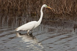
Great Egret, Bombay Hook National Wildlife Refuge, Delaware. Photo credit: Mike Carlo/USFWS
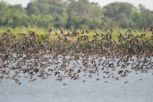
The impoundments at Bombay Hook National Wildlife Refuge are nationally known birding hotspots, especially for shorebirds, waterfowl, and wading birds. Bombay Hook NWR has been designated a Ramsar Wetland of International Importance as well as a Globally Important Bird Area. U.S. Fish and Wildlife lists 278 birds that use the wider refuge and eBird reports counts of 239 species at Raymond Pool, 219 species at Shearness Pool, 226 species at Bear Swamp, and 178 species at Finis Pool. Raymond Pool hosts especially impressive numbers of shorebirds and waterfowl with high counts of 10,100 Dunlin; 7,000 Semipalmated Sandpiper; nad 4,890 Short-billed Dowitcher.
The impoundments at Bombay Hook NWR are managed under a moist soil management regime with water levels are drawn down in the spring to provide mudflats for migrating shorebirds. This permits the germination and growth of lush vegetation, and wading birds feed on fish in the pools that form. The impoundments are then flooded in the fall to give dabbling ducks access to the seeds of the wetland plants. In the spring the cycle begins again. Invasive Common Reed (Phragmites australis) has been an ongoing challenge in maintaining the productivity of the impoundments.
Vulnerability
Most of the impoundments at Bombay Hook NWR are sheltered by vegetated marsh but still experience occasional overtopping. Shearness Pool is exposed to higher wave energy due to the fact that it borders a large unvegetated intertidal flat. While Bombay Hook has not experienced any failures of their imoundments they are subject to occasional overwash and occasional cave-ins due to localized muskrat activity.
Human Value
Bombay Hook NWR receives approximately 110,000 visitors every year and is the most popular birding site in the State of Delaware. Bombay Hook staff, lead a variety of environmental education and interpretation programs each year for local schools and collaborate on research with the University of Delaware and Delaware State University.
Literature Resources
Below is a list of articles describing research occurring at or near the impoundments:
Anderson, J. T. 2006. Evaluating competing models for predicting seed mass of Walter’s millet. Wildlife Society Bulletin 34:156-158.
Breese, G., K. Kalasz, J. Lyons, C. Boal, J. Clark, M. DiBona, R. Hossler, B. Jones, B. Meadows, M. Stroeh, B. Wilson, and M. Runge. Structured decision making for coastal managed wetlands in Delaware. Shepherdstown, West Virginia: United States Fish and Wildlife Service, National Conservation Training Center; 2010.
Chamberlain, E. B. A survey of the marshes of Delaware. Dover, Delaware: The State of Delaware, Board of Game and Fish Commissioners; 1951.
Chan, S., and S. Shulte. A Plan for Monitoring Shorebirds During the Non-breeding Season in Bird Monitoring Region Delaware – BCR 30. Manomet, Massachusetts: Manomet Center for Conservation Sciences; 2003.
Conroy, M. J., G. R. Costanzo, and D. B. Stotts. 1989. Winter survival of female American black ducks on the Atlantic coast. The Journal of Wildlife Management 53:99-109.
Detterline, J., and W. Wilhelm. 1991. Survey of pathogenic Naegleria fowleri and thermotolerant amebas in federal recreational waters. Transactions of the American Microscopical Society 110:244-261.
Erwin, R. M., D. K. Dawson, D. B. Stotts, L. S. McAllister, and P. H. Geissler. 1991. Open marsh water management in the mid-Atlantic region: aerial surveys of waterbird use. Wetlands 11:209-228.
Green, A., J. Lyons, M. Runge, W. Kendall, H. Laskowski, S. Lor, and S. Guiteras. Timing of impoundment drawdowns and impact on waterbird, invertebrate, and vegetation communities within managed wetlands, Study manual – Final version field season 2007. Laurel, Maryland: USGS Patuxent Wildlife Research Center; 2007.
Green, A. W., W. L. Kendall, H. P. Laskowski, J. E. Lyons, L. Socheata, and M. C. Runge. Draft version of the USFWS R3/R5 Regional Impoundment Study. Washington, D. C.: U. S. Fish and Wildlife Service; 2008.
Griffith, R. 1946. Nesting of Gadwall and Shoveller on the Middle Atlantic Coast. The Auk 63:436-438.
Harding, J. J. 1980. Birding the Delaware Valley Region: A Comprehensive Guide to Birdwatching in Southeastern Pennsylvania, Central and Southern New Jersey, and Northcentral Delaware. Temple University Press, Philadelphia, Pennsylvania.
Hill, M. R., and R. B. Frederick. 1997. Winter movements and habitat use by greater snow geese. The Journal of Wildlife Management 61:1213-1221.
IWMM [Integrated Waterbird Management and Monitoring Project]. Project Update – October 2010. http://iwmmprogram.ning.com/: Integrated Waterbird Management and Monitoring Project; 2010.
Lunt, D. C. 1986. Taylors Gut: In the Delaware State. Middle Atlantic Press, Wilmington, Delaware.
Mather, T. Nitrogen and phosphorous analysis of Raymond and Shearness impoundments, Bombay Hook NWR, Summer 1979.
Unpubl. Report. Newark, Delaware: Dept.of Entomology and Applied Ecology, Univ.of Delaware; 1979.
Mathis, W. N., and T. Zatwarnicki. 2010. New Species and Taxonomic Clarifications for Shore Flies from the Delmarva States (Diptera: Ephydridae). Proceedings of the Entomological Society of Washington 112:97-128.
Anonymous. Effects of open marsh water management (OMWM) on bird populations of a Delaware tidal marsh, and OMWM’s use in waterbird habitat restoration and enhancement. Waterfowl and wetlands symposium: proceedings of a symposium on waterfowl and wetlands management in the coastal zone of the Atlantic Flyway. Delaware Coastal Management Program, Delaware Department of Natural Resources and Environmental Control, Dover, DE; 1987. 298 p.
Murphey, F. J., and P. P. Burbutis. 1967. Straw Infusion Attractiveness to Gravid Female Culex salinarius. Journal of Economic Entomology 60:156-161.
Murray, M. 2014. Delaware gets millions to help beaches, wetlands. Delaware Online June 8, 2014:1.
Murray, M., and J. Montgomery. 2012. Marsh impoundments create questions on future responses by state officials. Delaware Online October 23, 2012:1.
Philipp, K. R. 2005. History of Delaware and New Jersey salt marsh restoration sites. Ecological Engineering 25:214-230.
Pinkney, A. E., P. C. McGowan, D. R. Murphy, T. P. Lowe, D. W. Sparling, and L. C. Ferrington. 2000. Effects of the mosquito larvicides temephos and methoprene on insect populations in experimental ponds. Environmental Toxicology and Chemistry 19:678-684.
Wayne, W. J., and T. E. Roberts. 1972. The Summer Scene. The Delmarva Ornithologist 7:4-6.
Wilson, B., D. Siok, C. Pinkerton, K. Smith, and B. Scarborough. Evaluating the Evolution of Natural Tidal and Managed Wetlands in Delaware. A presentation given at DE Wetlands Conference. Dover, Delaware: Delaware National Estuarine Research Reserve; 2012.

Site Description
State: Delaware
County: New Castle
Ownership: Private
Impoundments
Broad Dyke Marsh: 136 acres
Ecology and Management
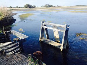
Broad Dyke Marsh is located just north of New Castle, DE. It is a fairly small impoundment at only 55 acres, but is unique in the fact that the original dikes date back to the 1655 and were constructed by Dutch settlers, making it likely one of the oldest impoundments in the country. There is no data available on the bird species which use the dyke, but there have been extensive vegetation surveys and the site that has shown that treatment and improved management of the water level has improved native vegetation diversity and drastically reduced invasive phragmites. The site is owned by the Trustees of New Castle Commons, a local non-profit group.
Vulnerability
The impoundment is vulnerable to coastal storms and sea-level rise and experience damage during Sandy. The impoundment is a critical buffer for the town of Historic New Castle by absorbing the influx of water during these severe coastal storms and failure of the dike would be catastrophic to low-lying areas of the town.
Human Value
There is no human use data for this site, but it is located near Historic New Castle, a popular tourist destination in Delaware as well as along the East Coast Greenway bicycle trail. There are no known educational or outreach activities at Broad Dyke Marsh.
Literature Resources
Below is a list of articles describing research occurring at or near the impoundments:
Catts, W. P., and T. Mancl. “To keep the banks, dams and sluices in repair”: an historical context for Delaware River dikes, New Castle County, Delaware. Dover, Delaware: Delaware Department of Natural Resources and Environmental Control; 2013.
DDNREC [Delaware Department of Natural Resources and Environmental Control]. Northern Delaware Wetland Rehabilitation Program. Dover, Delaware: Delaware Department of Natural Resources and Environmental Control; 2001.
Greenstone Engineering, I. Broad Marsh Dike Operation and Maintenance Manual. Wilmington, Delaware: Greenstone Engineering, Inc.; 2011.
Kalasz, K., C. Boal, G. Breese, J. Clark, M. DiBona, R. Hossler, B. Jones, J. Lyons, R. E. Meadows, M. Stroeh, and B. Wilson. The importance of impoundments to wildlife: managing now and into the future. A presentation given at the Delaware Wetlands Conference. Dover, Delaware: Delaware Department of Natural Resources and Environmental Control; 2012.
Meredith, W. H., T. J. Moran, and R. E. Meadows. Managing Delaware’s Coastal Wetlands for Biodiversity. Dover, Delaware: Delaware Department of Natural Resources and Environmental Control; 2002.

Site Description
State: Delaware
County: Sussex
Ownership: State
Impoundments
Gordon’s Pond: 317 acres
Ecology and Management

.
Gordon’s Pond is a saltwater impoundment located in Cape Henlopen State Park.
Gordon’s Pond is a saltwater impoundment located in Cape Henlopen State Park along the Atlantic coast of Delaware. It is thought to have originated centuries ago as a result of salt harvesting activities (Forney 2014). Currently, the impoundment is managed both for mosquito control and to provide habitat for migratory shorebirds and waterfowl. According to eBird, 232 species have been observed at this site. The water levels are managed by the Delaware State Parks system and generally allowed to fill during winter and is drawn down in the summer. Inputs come from both rain water as well as from the Lewes-Rehoboth Canal.
Vulnerability
“These days, it’s only a rare and powerful nor’easter that breaks through the dunes every 10 years or so to push ocean water into Gordons Pond.”
– (Forney 2014)
Gordon’s Pond is impounded to the east by a natural dune system, which experiences breaches on average once every 10 years during coastal storms. Despite these breaches the dunes which impound Gordon’s pond are healthy and not predicted to be especially vulnerable to the impacts of climate change.
Human Value
Being situated directly adjacent to the Delaware beaches and between the popular towns of Lewes and Rehoboth Beach, Gordon’s Pond receives large numbers of visitors in the summer months.
Literature Resources
Below is a list of articles describing research occurring at or near the impoundments:
Forney, D. 2014. Gordons Pond water levels and our salt-gathering past. Cape Gazette June 20, 2014:1.
GPWG [Gordons Pond Working Group]. Preliminary assessment of trail alternatives. Dover, Delaware: Delaware Department of Natural Resources and Environmental Control; 2010.
Manomet [Manomet Center for Conservation Science]. 2015. ISS/PRISM Tools: Site Map, Site List and Site Reports. 2015:1.

Site Description
State: Virginia
County: Accomack
Ownership: Federal
Impoundments
Black Duck Pool (A pool)
Farm Fields Pool
Gadwall Pool (E pool)
Mallard Pool (C pool)
North Wash Flats
Old Fields
Pintail Pool (D pool)
Ragged Point
Shoveler Pool (B-North pool)
Snow Goose Pool (B-South pool)
South Wash Flats
Sow Pond
Swan Cove Pool (F-Pool)
Total: 2353 acres
Ecology and Management

Birds feeding off Swan’s Cove Trail at Chincoteague National Wildlife Refuge. Credit: Emma Kerr/USFWS
Most of the impoundments at Chincoteague NWR were constructed in the 1950s and 1960’s to provide migratory bird protection, with the primary purpose of providing waterfowl migration and wintering habitat. When first established the Refuge focused more on single species management. Today, however, the Refuge manages impoundments for a suite of wildlife throughout the year. The impoundments also supply numerous habitat benefits, including wintering/migratory habitat for waterfowl; fresh/brackish vegetation roots and seed as food for wintering waterfowl; food sources for waterbirds of conservation concern such as snowy egret, glossy ibis, Forster’s and gull-billed terns; and shorebird migratory stopover habitat for many species of conservation concern, including short-billed dowitcher, dunlin, and semipalmated sandpiper. The Refuge also manages habitat for American black ducks, as part of a long-term effort, in compliance with the North American Waterfowl Management Plan. The impoundments are also managed for a range of aquatic species and other species of conservation concern. Several federal and state endangered and threatened species are also found within the Refuge. They include: piping plover (FT), red knot (FT), roseate tern (FE), Delmarva fox squirrel, Northern long-eared bat (FT), gull-billed tern (ST), Wilson’s plover (SE), and peregrine falcon (ST).
To support the wide array of bird species found at the Refuge, impoundment water levels are closely managed to provide adequate food, in the form of vegetation (seed or roots) and/or aquatic invertebrates, fresh water, and loafing areas. However, all Refuge impoundment management strategies depend entirely on precipitation as their sole source of freshwater for the generation of fresh/brackish water plants, and gravity or evaporation for drawdown. Both mechanisms limit management capabilities. Tidal cycles and strong coastal storm events, especially nor’easters and hurricanes, further challenge the attainment of management goals for impoundments. Non-native Phragmites also poses a management challenge.
Vulnerability
Chincoteague’s impoundments are located between mean high and spring high tide and abut upland areas as well as fresh or brackish marshes not affected by tides. Because the impoundments generally are located above the high tide level, estuarine water cannot enter them. However, tidal influx can occur through the Virginia Creek water control structure (WCS) into Old Fields Impoundment. During severe weather and extreme high tides, overwash reaches impoundments from the sea and Bay side; Black Duck (A) Pool, Snow Goose (B-South) Pool, Shoveler (B-North) Pool, Mallard (C) Pool, Pintail (D) Pool, Swan Cove (F) Pool, Wash Flats, and Old Fields impoundments are most susceptible. As noted previously, because the impoundments depend on precipitation for freshwater inputs, tidal cycles and strong coastal storm events, especially nor’easters and hurricanes, challenge the attainment of management goals for impoundments. Additionally, as sea level continues to rise and more frequent overwash events occur, the Refuge expects damage to dikes and other impoundment infrastructure. Maintaining water depths at desirable levels may also become more difficult.
Human Value
Chincoteague NWR provides significant recreation and education opportunities for visitors. Specifically, the impoundments concentrate large flocks of birds, providing wildlife viewing, and opportunities for photography, education, and interpretation. In 2010, approximately 1.4 million people visited the Refuge. In terms of education, the Refuge offers a wide range of programming, including day camps to family programs, and undergraduate and graduate research opportunities. The Refuge also works with local K to 12 schools, communities, and educational organizations to provide classroom and hands-on programs both on and off the refuge for youth. Teacher workshops and Teacher Guided Learning Opportunities are also available.
Acknowledgements
We are grateful to Kevin Holcomb, USFWS Chincoteague National Wildlife Refuge, for providing helpful information used on this page.
Literature Resources
Below is a list of articles describing research occurring at or near the impoundments:
Carson, Rachel. Chincoteague: A National Wildlife Refuge. Washington, D. C.: U. S. Fish and Wildlife Service; 1947.
Conroy, M. J., G. R. Costanzo, and D. B. Stotts. 1989. Winter survival of female American black ducks on the Atlantic coast. The Journal of Wildlife Management 53:99-109.
Green, A., J. Lyons, M. Runge, W. Kendall, H. Laskowski, S. Lor, and S. Guiteras. Timing of impoundment drawdowns and impact on waterbird, invertebrate, and vegetation communities within managed wetlands, Study manual – Final version field season 2007. Laurel, Maryland: USGS Patuxent Wildlife Research Center; 2007.
Green, A. W., W. L. Kendall, H. P. Laskowski, J. E. Lyons, L. Socheata, and M. C. Runge. Draft version of the USFWS R3/R5 Regional Impoundment Study. Washington, D. C.: U. S. Fish and Wildlife Service; 2008.
Hinke-Sacilotto, I. 2005. Chincoteague National Wildlife Refuge: An Ecological Treasure. Big Earth Publishing, Boulder, Colorado.
IWMM [Integrated Waterbird Management and Monitoring Project]. Project Update – October 2010. http://iwmmprogram.ning.com/: Integrated Waterbird Management and Monitoring Project; 2010.
Morton, J. M., R. L. Kirkpatrick, and M. R. Vaughan. 1990. Changes in body composition of American black ducks wintering at Chincoteague, Virginia. Condor 92:598-605.
Schulte, S., and S. Chan. A Plan for Monitoring Shorebirds During the Non-breeding Season in Bird Monitoring Region Virginia – BCR 30 and 27.
Manomet, Massachusetts: Manomet Center for Conservation Science; 2008.
USFWS [United States Fish and Wildlife Service]. Chincoteague and Wallops Island National Wildlife Refuges Draft Comprehensive Conservation Plan and Environmental Impact Statement. Hadley, Massachusetts: U. S. Fish and Wildlife Service; 2006.

Site Description
State: Maryland
County: Somerset
Ownership: State
Impoundments
Deal Island Impoundment: 2659 acres
Ecology and Management

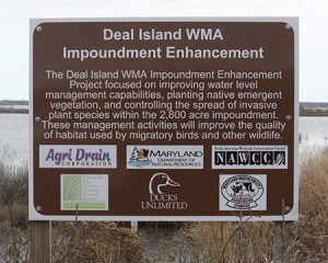
Increasing submerged aquatic vegetation (SAV) is one of the management goals for the Dear Island impoundment.
Deal Island Wildlife Management Area (13,000 acres) includes a single large impoundment (> 2500 acres) along the lower Chesapeake Bay in Somerset County, Maryland. Deal Island WMA is part of the larger Somerset-Wicomico Marshes Important Birding Area (IBA) as identified by the National Audubon Society. According to eBird, 207 bird species have been identified within the Deal Island impoundment. Among them, two Highest Priority species for Bird Conservation Region (BCR) 30, American Black Duck and Saltmarsh Sharp-tailed Sparrow, are abundant at Deal Island. Additional Priority NAWCA (North American Wetland Conservation Act) Species including: Pied-billed Grebe, Horned Grebe, American Bittern, Least Bittern, Snowy Egret, Bald Eagle, Solitary Sandpiper, Lesser Yellowlegs, Semipalmated Sandpiper, Short-billed Dowitcher, Least Tern, Short-eared Owl, and Seaside Sparrow also use the impoundment.
The original tidal marsh at Deal Island WMA was impounded in the 1960s. Between its creation and the 1990s, the impoundment was important habitat for waterfowl and wading birds. Peak numbers of waterfowl sometimes exceeded 20,000 birds. However in the mid-1990s the number and diversity of birds began to decline and submerged aquatic vegetation was much less abundant. This trend continued until 2009 when a new management regime, based around increasing the amount of SAV was implemented. The water control structures were improved. Water levels are managed to promote SAV growth. In addition, hunting days have been limited and gas motors are prohibited to reduce disturbance and prevent damage to existing SAV beds. As a result of these changes the impoundment has seen a rebound in both SAV and waterfowl.
Vulnerability
The impoundment at Deal Island is highly vulnerable to sea-level rise and already experiences nearly weekly overtopping at the emergency spillway. In addition muskrat burrows also cause small leaks through the berm and there is some berm erosion during storm events. Despite being only 2 feet above mean high tide there have been no large scale failures in the past.
Human Value
There are no visitor use studies, but staff estimate that over 100 people visit the impoundment each week for hunting, crabbing or bird watching. Deal Island WMA also cooperates with the nearby Chesapeake Bay National Estuarine Research Reserve for research on SAV and the area is used by local grade schools and colleges for educational field trips. The impoundment also buffers State Route 326, the only road connection to the rural fishing community of Deal Island, from wave energy to the south.
Literature Resources
Below is a list of articles describing research occurring at or near the impoundments:
Carroll, L., K. Keller, C. Ervin, and P. Delgado. Baseline Characterization of a Deteriorating Wetland Community in the Deal Island Impoundment, Lower Eastern Shore, Maryland (Poster). Maryland: Chesapeake Bay National Estuarine Research Reserve; 2009.
Ducks Unlimited. Wetlands Enhanced on Deal Island Wildlife Management Area. 2015:1.
Erwin, R. M., D. K. Dawson, D. B. Stotts, L. S. McAllister, and P. H. Geissler. 1991. Open marsh water management in the mid-Atlantic region: aerial surveys of waterbird use. Wetlands 11:209-228.
MDNR [Maryland Department of Natural Resources]. Monitoring the Deal Island Impoundment at Monie Bay. 2015:1.
MDNR [Maryland Department of Natural Resources]. Deal Island WMA. http://dnr.maryland.gov/wildlife/publiclands/eastern/dealisland.asp 2015:1.
Walbeck, D. E. Use of Open Marsh Water Management Ponds by Ducks, Wading Birds, and Shorebirds During Late Summer and Fall. Frostburg, Maryland: Frostburg State University; 1989.

Site Description
State: Virginia
County: Accomack
Ownership: State
Impoundments
10 impoundments: 381 total acres
Ecology and Management
The impoundments at Doe Creek WMA provide habitat to many waterfowl, shorebirds, saltmarsh birds, wading birds, and provides breeding and wintering habitat to many species as well. This area also provides habitat for a range of invertebrates, fish, amphibians and reptiles, and mammals. The habitats that exist within the complex face a range of natural threats, including an ongoing invasion of Phragmites. The impoundments were constructed primarily for waterfowl management, which is still the primary management focus today. Waterfowl are managed through moist soil management.
Vulnerability
No erosion, over-topping, or storm damage has been documented to date. However, based on its location on the Eastern Shore, there could be some potential for future impacts.
Human Value
The WMA and its impoundments are located on the Eastern Shore in a relatively rural area. The area is primarily used for hunting and not educational purposes. No data exist on the number of visitors.
Acknowledgements
We are grateful to Steve Living, Virginia Department of Game and Inland Fisheries, for providing helpful information used on this page.
Literature Resources
Below is a list of articles describing research occurring at or near the impoundments:
None available

Site Description
State: Maryland
County: Worcester
Ownership: State
Impoundments
EAV 1: 2 acres
EAV 2: 15 acres
EAV 3: 17 acres
Ecology and Management
There are a number of smaller impoundments at E.A. Vaughn WMA, with the largest being approximately 17 acres. The site is used by fair numbers of waterfowl and wading birds. No impoundment-specific data are available for the site, but eBird shows that 222 species have been identified at E.A. Vaughn WMA. Notable findings include an observation of 120 Swamp Sparrows. The upland impoundments at E.A. Vaughn are managed as moist soils while the lower areas generally hold some water year-round.
Vulnerability
E.A. Vaughn WMA borders Chincoteague Bay to the east and the lower areas of the impoundment are vulnerable to sea-level rise and storm surge.
Human Value
There is no human use data available for this site.
Literature Resources
Below is a list of articles describing research occurring at or near the impoundments:
MDNR [Maryland Department of Natural Resources]. E. A. Vaughn WMA. http://dnr.maryland.gov/wildlife/publiclands/eastern/eavaughn.asp 2015:1.
USFWS [United States Fish and Wildlife Service]. Division of Bird Habitat Conservation 2006 Small Grants. Washington, D. C.: United States Fish and Wildlife Service; 2010.

Site Description
State: Maryland
County: Kent
Ownership: Federal
Impoundments
Headquarters Pond: 16 acres
Shipyard Creek: 5 acres
Ecology and Management
Eastern Neck National Wildlife Refuge contains two smaller impoundments. Eastern Neck NWR is the northernmost refuge in the larger Chesapeake Marshlands National Wildlife Complex, which stretches along the eastern shore of Maryland and Virginia. USFWS has identified 240 species of bird at the refuge. The impoundments are regularly surveyed by refuge staff and volunteers. These counts also include croplands on the refuge and adjacent tidal waters, but show robust populations of waterfowl from October – March with a high count of over 45,0000 Scaup (spp.) in the winter of 2004-2005.
There are three impounded moist soil units located on the refuge, only two of which are actively managed. The two managed moist soil units are the 16 acre Headquarters Pond and the 5 acre Ship Yard Creek. The Headquarters Pond unit was created prior to 1967 and Ship Yard Creek was constructed in 2007. Both units are allowed to fill in winter and then drawn down in spring and summer to promote freshwater wetland plant growth.
Vulnerability
Both of the impoundments at Eastern Neck NWR are located upland in relation to the tidal marshes and are therefore relatively protected from the impacts of sea-level rise and coastal storms.
Human Value
Easter Neck NWR receives over 70,000 visitors annually, most of whom participate in wildlife viewing. The refuge has partnered with many local and national outdoor recreation organizations as well as both the University of Maryland and University of Delaware.
Literature Resources
Below is a list of articles describing research occurring at or near the impoundments:
Baird, S. Eastern Neck National Wildlife Refuge Comprehensive Conservation Plan. Washington, D. C.: U. S. Fish and Wildlife Service; 2010.
Earnst, S. L., and J. Bart. 2013. Costs and benefits of extended parental care in Tundra Swans Cygnus columbianus columbianus. Wildfowl Suplement 1:260-267.
IWMM [Integrated Waterbird Management and Monitoring Project]. Project Update – October 2010. http://iwmmprogram.ning.com/: Integrated Waterbird Management and Monitoring Project; 2010.
Staines, C. L., and S. L. Staines. 2011. The Carabidae (Insecta: Coleoptera) of Eastern Neck National Wildlife Refuge, Maryland. Banisteria 38:71-84.
Staines, C. L., and S. L. Staines. 2005. The Dytiscidae and Hydrophilidae (Insecta: Coleoptera) of Eastern Neck National Wildlife Refuge, Maryland. Maryland Naturalist 47:14-20.

Site Description
State: New Jersey
County: Ocean
Ownership: Federal
Impoundments
Barnegat #1: 18.9 acres
Barnegat #2: 7.06 acres
Barnegat #3: 8.11 acres
Barnegat #4: 82.06 acres
Barnegat #5: 109.79 acres
Ecology and Management

Great egret landing at Edwin B. Forsythe NWR. Photo credit: Rosie Walunas/USFWS.
The Barnegat impoundments are in the central section of the Edwin B. Forsythe National Wildlife Refuge along Barnegat Bay in Ocean County, New Jersey. They are less visited than the extremely popular Wildlife Drive impoundments to the south (also in Forsythe NWR), but they are popular birding spots nonetheless. For example, Barnes (2009) reports 3,800 Greater Scaup, 230 Northern Shovelers, and 200 Northern Pintail using the impoundments during spring migration. Shorebirds and herons are also plentiful where mudflats and shallow waters occur. The site is included in both the International Shorebird Survey (ISS; Chan and Schulte 2008) and the Integrated Waterbird Management and Monitoring (IWMM) programs. Forsythe NWR as a whole is designated a Western Hemisphere Shorebird Reserve Network site due to its abundant wetlands and location along the Atlantic Flyway.
The impoundments were originally created as a joint effort of state wildlife and county mosquito control agencies in the late 1960s, and were later acquired by the US Fish and Wildlife Service as part of Forsythe NWR. Due to their distance from headquarters and structural problems associated with their construction, water levels have not been actively managed at this site for some time. Some efforts were made in the 2000s to rehabilitate them in partnership with Ducks Unlimited. However, due to further storm damage, at least two of the five are breached and open to tidal flow, and the other three currently have non-functional water control structures. Forsythe recently performed an engineering assessment of all dams on the refuge including the Barnegat dikes. This, along with a habitat value assessment, resulted in the current plan to transition them from freshwater impoundments back to unmanaged, tidal ecosystems.
Vulnerability
Frequent overtopping and structural instability make the Barnegat impoundments extremely vulnerable to sea level rise and storms.
Human Value
The number of visitors to the Barnegat area of Forsythe NWR is unknown, but the refuge as a whole receives well over 250,000 visitors per year. The Barnegat impoundments are a popular birding spot, and are designated an Important Bird Area due to the abundance and diversity of coastal birds using the site. Approximately 3.9 million people live within 100 kilometers of Edwin B. Forsythe NWR.
Acknowledgements
We are grateful to Paul M. Castelli and Virginia Rettig (Forsythe NWR) and Joseph Schmidt (Ocean County Mosquito Extermination Commission) for providing helpful information used on this page.
Literature Resources
Below is a list of articles describing research occurring at or near the impoundments:
Atzert, S. P. Edwin B. Forsythe National Wildlife Refuge Comprehensive Conservation Plan. Hadley, Massachusetts: U.S. Department of the Interior, Fish and Wildlife Service, Region 5; 2004.
Barnes, S. 2009. Region 3, Waterfowl – Rails. New Jersey Birds 35:103-104.
Castelli, P. Hurricane Sandy resilience projects in New Jersey: Edwin B. Forsythe, Cape May and Supawna Meadows National Wildlife Refuges. Hadley, Massachusetts: Presentation given at the Hurricane Sandy Tidal Marsh Resiliency Coordination Workshop December 8-9, 2014.
Cramer, D. Estimating habitat carrying capacity for American black ducks wintering in southern New Jersey. University of Delaware; 2009.
Ducks Unlimited. Wetland Restoration on New Jersey’s Atlantic Coast. http://www.ducks.org/new-jersey/new-jersey-projects/wetland-restoration-on-new-jerseys-atlantic-coast 2015:1.
Giroux, J., G. Gauthier, G. Costanzo, and A. Reed. 1998. Impact of geese on natural habitats. Pages 32-57 In Batt, B. D. J., editor. The Greater Snow Goose: report of the Arctic Goose Habitat Working Group, US Fish and Wildlife Service and Canadian Wildlife Service, Washington, DC and Ontario, Canada.
IWMM [Integrated Waterbird Management and Monitoring Project]. Project Update – October 2010. http://iwmmprogram.ning.com/: Integrated Waterbird Management and Monitoring Project; 2010.
Kerlinger, P. The economic impact of ecotourism on the Edwin B. Forsythe National Wildlife Refuge area, New Jersey, 1993-1994. Unpublished Report; 1995.
WHSRN [Western Hemisphere Shorebird Reserve Network]. 2009. Edwin B. Forsythe NWR. http://www.whsrn.org/site-profile/edwin-b-forsythe-nwr Accessed 2015:1.

Site Description
State: New Jersey
County: Ocean
Ownership: Federal
Impoundments
Stouts Creek East: 45 acres
Stouts Creek North: 16.67 acres
Stouts Creek West: 64 acres
Wrangle Creek East: 7.29 acres
Wrangle Creek West: 10.3 acres
Ecology and Management
Stouts and Wrangle Creeks are two groups of impoundments located within Edwin B. Forsythe National Wildlife Refuge along Barnegat Bay in Ocean County, New Jersey. The Wrangle Creek impoundments were constructed in the 1940s by the State of New Jersey for waterfowl management. One of the Stouts Creek impoundments was created in the 1950s by a waterfowl hunting club, while the other was added in 1972 by state and local agencies for both mosquito control and waterfowl. Both sites are currently owned by Forsythe NWR and are not open to the public. Stouts Creek West is currently breached and all four have non-functional water control structures. Forsythe NWR recently evaluated the structural soundness of these impoundments and found that the high costs of operation and maintenance, along with a habitat value assessment, justify restoring them to open, tidal salt marsh systems.
Vulnerability
These impoundments have low dikes (~2 feet above mean high water) and are therefore subject to overtopping and erosion. Forsythe NWR will be transitioning both sites from freshwater to tidal, non-managed systems in the near future.
Human Value
Stouts and Wrangle Creek are located in an isolated area of Forsythe NWR (boat-access only) and are not open to the public. The broader refuge receives over 250,000 visitors per year and is within 100 km of nearly 4 million people (whsrn.org).
Acknowledgements
We are grateful to Paul M. Castelli and Virginia Rettig (Forsythe NWR) and Joseph Schmidt (Ocean County Mosquito Extermination Commission) for providing helpful information used on this page.
Literature Resources
Below is a list of articles describing research occurring at or near the impoundments:
Atzert, S. P. Edwin B. Forsythe National Wildlife Refuge Comprehensive Conservation Plan. Hadley, Massachusetts: U.S. Department of the Interior, Fish and Wildlife Service, Region 5; 2004.
WHSRN [Western Hemisphere Shorebird Reserve Network]. 2009. Edwin B. Forsythe NWR. http://www.whsrn.org/site-profile/edwin-b-forsythe-nwr Accessed 2015:1.

Site Description
State: New Jersey
County: Ocean
Ownership: Federal
Impoundments
East Pool: 549.32 acres
Northwest Pool: 526.58 acres
Southwest Pool: 296.56 acres
Ecology and Management

Black ducks at the Edwin B. Forsythe National Wildlife Refuge, NJ. Photo: Henry McLin (2011) USFWS FLICKR.
The Wildlife Drive impoundments of Forsythe National Wildlife Refuge are renowned for their abundance and diversity of waterfowl, shorebirds, and other water birds. Edwin B. Forsythe National Wildlife Refuge has been designated a Western Hemisphere Shorebird Reserve Network site based on the criterion of hosting over 20,000 shorebirds annually. Within the impoundments, 239 bird species have been reported to eBird.org, including impressive high counts of shorebirds and waterfowl. For example, highs of 8,300 Dunlin and 7,600 Semipalmated Sandpiper were reported in East Pool; 8,200 Northern Pintail in Southwest Pool; and 9,500 American Black Duck in Northwest Pool (as of April 2016). Migratory and wintering birds in the impoundments are also monitored by refuge staff and volunteers as part of the national Integrated Waterbird Management and Monitoring program and the International Shorebird Survey (Chan and Shulte 2008).
The impoundments are fed by Doughty Creek and Lily Lake, which allow the Northwest and Southwest Pools to be managed as freshwater. East Pool has been converted to a salt water management regime with water levels managed via tide gates. West Pool is generally drawn down during shorebird migration, which also stimulates the growth of seed-bearing annual moist soil plants. The West Pool is gradually re-flooded during the fall, which results in expanded foraging areas for dabbling ducks and wading birds. The water levels of East Pool fluctuate with the tides but on a delay so that during high tide on the surrounding marsh the impoundment mudflats are exposed and vice versa. The proliferation of Common Reed (Phragmites australis) has been an ongoing challenge (Sun et al. 2007), but has lessened in West Pool due to targeted control and in the East Pool due to the transition to a salt water management regime.
Vulnerability
The Wildlife Drive impoundments at Forsythe NWR are partially sheltered by salt marsh and a barrier island but are nevertheless vulnerable to sea level rise and extreme weather events. The top of the embankments stand at approximately 5 feet above the mean high tide level and have experienced storm damage and erosion over the years. They suffered severe damage during 2012’s Hurricane Sandy when embankments were breached in several places, requiring extensive and costly repairs.
Human Value
The area of Forsythe NWR around the impoundments receives an estimated 120,000 visitors per year, most drawn by the abundance and easy viewing of birds. A dirt road (“Wildlife Drive”) surrounding the impoundments is one of the most popular birding destinations in the state (Applegate and Clark 1987, Kerlinger 1995). Approximately 3.9 million people live within 100 kilometers of Edwin B. Forsythe NWR.
Acknowledgements
We are grateful to Paul M. Castelli and Virginia Rettig (Forsythe NWR) for providing helpful information used on this page.
Literature Resources
Below is a list of articles describing research occurring at or near the impoundment:
ALS [American Litoral Society]. Assessing the impacts of Hurricane Sandy on coastal habitats. Highlands, New Jersey: American Littoral Society; 2012.
Applegate, J. E., and K. E. Clark. 1987. Satisfaction levels of birdwatchers: An observation on the consumptive—nonconsumptive continuum. Leisure Sciences: An Interdisciplinary Journal 9:129-134.
Atzert, S. P. Edwin B. Forsythe National Wildlife Refuge Comprehensive Conservation Plan. Hadley, Massachusetts: U.S. Department of the Interior, Fish and Wildlife Service, Region 5; 2004.
Brown, A., and H. Sun. First Year (Winter 2000) Evaluation of Different Treatments for Controlling Phragmites in the East Pool. Lawrenceville, New Jersey: Rider University; 2000.
Brown, A., and H. Sun. Draft report for baseline investigation of managing Phragmites australis in the Edwin B. Forsythe National Wildlife Refuge. Lawrenceville, New Jersey: Rider University; 1999.
Brown, A., H. Sun, and F. Petrino. Second year (2001) post-treatment evaluation for controlling phragmites in the East Pool at EBFNWR, Brigantine, NJ. Lawrenceville, New Jersey: Rider University; 2002.
Castelli, P. Hurricane Sandy resilience projects in New Jersey: Edwin B. Forsythe, Cape May and Supawna Meadows National Wildlife Refuges. Hadley, Massachusetts: Presentation given at the Hurricane Sandy Tidal Marsh Resiliency Coordination Workshop December 8-9, 2014.
Chan, S., and S. Shulte. A Plan for Monitoring Shorebirds During the Non-breeding Season in Bird Monitoring Region New Jersey – BCR 30. Manomet, Massachusetts: Manomet Center for Conservation Science; 2008.
Conroy, M. J., G. R. Costanzo, and D. B. Stotts. 1989. Winter survival of female American black ducks on the Atlantic coast. The Journal of Wildlife Management :99-109.
Conroy, M. J., G. Costanzo, and D. Stotts. Winter movements of American black ducks in relation to natural and impounded wetlands in New Jersey. Waterfowl and wetlands symposium: proceedings of a symposium on waterfowl and wetlands management in the coastal zone of the Atlantic flyway. Dover, Delaware: Delaware Department of Natural Resources and Environmental Control; 1987. 31 p.
Conroy, M. J., J. R. Goldsberry, J. E. Hines, and D. B. Stotts. 1988. Evaluation of aerial transect surveys for wintering American black ducks. The Journal of Wildlife Management 52:694-703.
Cramer, D. Estimating habitat carrying capacity for American black ducks wintering in southern New Jersey. University of Delaware; 2009.
Ducks Unlimited. Wetland Restoration on New Jersey’s Atlantic Coast. 2015:1.
Erwin, R. M., J. S. Hatfield, M. A. Howe, and S. S. Klugman. 1994. Waterbird use of saltmarsh ponds created for open marsh water management. The Journal of Wildlife Management 58:516-524.
Erwin, R. M., D. K. Dawson, D. B. Stotts, L. S. McAllister, and P. H. Geissler. 1991. Open marsh water management in the mid-Atlantic region: aerial surveys of waterbird use. Wetlands 11:209-228.
Giroux, J., G. Gauthier, G. Costanzo, and A. Reed. 1998. Impact of geese on natural habitats. Pages 32-57 In Batt, B. D. J., editor. The Greater Snow Goose: report of the Arctic Goose Habitat Working Group, US Fish and Wildlife Service and Canadian Wildlife Service, Washington, DC and Ontario, Canada.
Goldstein, M. A Comparison of Sampling Methodologies to Improve Estimates of Available Food for American Black Ducks in New Jersey. University of Delaware; 2012.
Haglan, B., and M. Spratt. Habitat Management Plan Edwin B. Forsythe National Wildlife Refuge. Galloway, New Jersey: U.S. Fish and Wildlife Service; Date unknown.
IWMM [Integrated Waterbird Management and Monitoring Project]. Project Update – October 2010. Integrated Waterbird Management and Monitoring Project; 2010.
Jones III, O. E., C. K. Williams, and P. M. Castelli. 2014. A 24-Hour Time-Energy Budget for Wintering American Black Ducks (Anas rubripes) and its Comparison to Allometric Estimations. Waterbirds 37:264-273.
Jones, O. Constructing a 24 hour time-energy budget for American black ducks wintering in coastal New Jersey. University of Delaware; 2012.
Kerlinger, P. The economic impact of ecotourism on the Edwin B. Forsythe National Wildlife Refuge area, New Jersey, 1993-1994. Unpublished Report; 1995.
Sun, H., A. Brown, J. Coppen, and P. Steblein. 2007. Response of Phragmites to environmental parameters associated with treatments. Wetlands Ecology and Management 15:63-79.
WHSRN [Western Hemisphere Shorebird Reserve Network]. 2009. Edwin B. Forsythe NWR.

Site Description
State: Maryland
County: Somerset
Ownership: State
Impoundments
Fairmount East: 184 acres
Fairmount West: 132 acres
Fairmount North 1: 12 acres
Fairmount North 2: 18 acres
Ecology and Management
Fairmount WMA is managed by the Maryland Department of Natural Resources and located in Somerset County on Maryland’s Eastern Shore. There are two main impoundments at the site; the 184 acre East Impoundment and 130 acre West Impoundment. Two additional impoundments, currently overgrown and unused occur to the north of Fairmount West. There are no official data on the wildlife present at the site, but eBird lists 140 species observed at the East Impoundment and 90 species at the West Impoundment. Notable high counts for the impoundments include over 1,000 Dunlin and nearly 3,000 Green Winged Teal.
The impoundments are managed for the production of submerged aquatic vegetation.
Vulnerability
The dikes at Fairmount WMA are only 2 feet above MHW and are extremely vulnerable to the effects of sea-level rise and coastal storms. There are also problems with muskrat burrows causing small collapses in the dikes.
Human Value
The site is used mostly by hunters as well as some birders and crabbers.
Literature Resources
Below is a list of articles describing research occurring at or near the impoundments:
MDNR [Maryland Department of Natural Resources]. Fairmount WMA. http://www.dnr.state.md.us/wildlife/Publiclands/eastern/fairmount.asp 2015:1.

Site Description
State: New Hampshire
County: Rockingham
Ownership: Federal
Impoundments
Stubbs Pond: 52 acres
Ecology and Management
The Great Bay National Wildlife Refuge has five freshwater impoundments. However four of the five impoundments don’t function as traditional impoundments. Two are created by dams along a freshwater stream to provide drinking water and two are very tiny ponds that are not managed. Stubbs Pond is the only traditional impoundment in the refuge. It was built in 1963 to provide fishing and boating opportunities to military personnel. However now it is primarily managed to support migratory waterfowl.1 Because Stubbs pond is in a restricted area in the refuge, there is very little eBird data available and no IWMM surveys are conducted at the impoundment (older shorebird surveys indicated little to no shorebird use). However, there are winter bird use data (December to April) from 2010 to 2012. Best available data is listed in the Great Bay NWR Comprehensive Conservation Plan (CCP). According to reports by NH Fish & Game, waterfowl concentrations are highest in the fall, when over 500 ducks and geese have been observed feeding in the impoundment. Several uncommon and state-threatened species have also been observed breeding in the impoundment, including least bittern, sora, common gallinule, pied-billed grebe, and king rail.
While Stubbs pond may not host as many birds as impoundments further south along the Atlantic Coast, it does provide important habitat to a wide range of species and it is recognized as a high-priority waterfowl location within the state of New Hampshire.2
[1] https://www.fws.gov/refuge/Great_Bay/what_we_do/finalccp.html
[2] Personal communication with refuge staff. 2015.
Vulnerability
There are no known records of the impoundment being overtopped during a storm. Erosion has occurred in certain areas around the dam, however it is not known if the erosion was due to a storm event or constant processes. According to the CCP, the dam is in “poor” condition, largely because of the erosion. The “poor” the rating indicates that “a potential dam safety deficiency is clearly recognized for normal loading conditions. Corrective actions to resolve the deficiency are recommended.”
Human Value
Approximately 30,000 people visit the refuge each year.3 There are only two trails on the refuge that are open to the public, and neither provides access to Stubbs Pond. Because Great Bay NWR is a non-staffed refuge, facilitated environmental education programming is not offered at this time.
[3] https://www.fws.gov/refuge/Great_Bay/what_we_do/finalccp.html
Acknowledgements
We are grateful to Nancy Pau and Bill Peterson (Park River NWR) for providing helpful information used on this page.
Literature Resources
Below is a list of articles describing research occurring at or near the impoundment:
Taylor, G. W., S. F. Marino, and S. B. Kahan. Great Bay National Wildlife Refuge and Karner Blue Butterfly Conservation Easement Comprehensive Conservation Plan. Hadley, Massachusetts: U.S. Department of the Interior, Fish and Wildlife Service, Northeast Regional Office; 2012.

Site Description
State: New Jersey
County: Cumberland
Ownership: State
Impoundments
Heislerville Main Pool: 55 acres
Heislerville North Impoundment: 131 acres
Heislerville South Impoundment: 119 acres
Heislerville West: 5 acres
“There may be no better spring shorebirding spot in NJ than at the Heislerville impoundment.”
-(Elia 2009)

Over 400 bird species have been reported from the Heislerville impoundments.
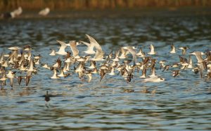
Heislerville Wildlife Management Area is a state-owned refuge along the Delaware Bayshore in rural Cumberland County, New Jersey. Four contiguous impoundments occur there near the mouth of the Maurice River. The Heislerville impoundments are known among birders as a superb site to see large concentrations of shorebirds, especially when area mudflats are covered by high tides. This is a primary reason it is considered a priority site within the Delaware Bayshore Important Bird Area by New Jersey Audubon. The impoundments are also considered a ‘focal area’ among east coast sites monitored as part of the International Shorebird Survey (ISS; Chan and Schulte 2008). Delaware Bay as a whole is considered an area of hemispheric importance in the Western Hemisphere Shorebird Reserve Network (WHSRN) as it hosts an estimated 500,000 shorebirds annually. The Heislerville impoundments are well birded. Over 400 eBird checklists have been submitted specifically from the impoundments and over 1,700 from Heislerville WMA as a whole. Over 200 species have been reported, including max counts of 8,000 Short-billed Dowitcher and 7,000 Semipalmated Sandpiper. One source indicates that it can serve as an important high-tide roost site for up to 50,000 individual shorebirds, mainly “peeps” (ALS 2012). A long-term research program studying Semipalmated Sandpiper migration at the site is run by scientists at New Jersey Audubon.
The history of the impoundments is unclear, but the three larger units had new water control structures installed in 2004 by Ducks Unlimited and partners (Kessler 2004). The press release states they were “restored through the installation of state-of-the-art water control structures that will allow for maximizing water level management capability. In turn, this will provide optimal feeding and resting opportunities for waterfowl, shorebirds, wading birds, and endangered Bald Eagles during critical times.” Management of the impoundments is performed by New Jersey Department of Environmental Protection (NJDEP) staff. Water levels in the main pool are dropped for northbound and southbound shorebird migration and raised again in the fall. Other pools may be kept full to allow fishing and crabbing activities.
Vulnerability
The Heislerville impoundments were “decimated” during Hurricane Sandy in 2012 (ALS 2012). Overtopping from storm surge caused severe erosion and breaches in the dikes, with an estimated repair cost of approximately $100,000 (AFSBSPT 2013). These embankments are not especially high, averaging about 3-4 feet above the mean high water line. Their proximity to the bay make them vulnerable to sea level rise.
Human Value
The impoundments are frequented by birders, photographers, and fishermen. Their embankments may provide some protection to the buildings and businesses that lie directly behind them on Matt’s Landing Road.
Acknowledgements
We are grateful to Dave Golden and Jason Hearson (NJDEP DFW) for providing information used on this page.
Literature Resources
Below is a list of articles describing research occurring at or near the impoundments:
AFSBSPT [Atlantic Flyway Shorebird Business Strategy Planning Team]. Hurricane Sandy Rapid Assessment – Final Report. Manomet, MA: Manomet Center for Conservation Sciences; 2013.
ALS [American Litoral Society]. Assessing the impacts of Hurricane Sandy on coastal habitats. Highlands, New Jersey: American Littoral Society; 2012.
Bauers, S. 2013. Report finds $50M in post-Sandy bird habitat projects needed. Philadelphia Inquirer / Philly.com January 3, 2013:1.
Chan, S., and S. Shulte. A Plan for Monitoring Shorebirds During the Non-breeding Season in Bird Monitoring Region New Jersey – BCR 30. Manomet, Massachusetts: Manomet Center for Conservation Science; 2008.
Elia, V. 2009. Region 5, Waterfowl – Terns. New Jersey Birds 35:109-111.
Kessler, C. Ducks Unlimited and Partners Finish Wetland Restoration Project at Heislerville Wildlife Management Area. http://www.outdoorcentral.com/mc/pr/04/05/20b8.asp: Ducks Unlimited; 2004.
Sutton, C., and J. Dowdell. Wintering raptors and waterfowl on the Maurice River Cumberland County, NJ: A twenty-year summary of observed status and trends, 1987-2007. Millville, NJ: Citizens United to Protect the Maurice River and Its Tributaries; 2009.

Site Description
State: Virginia
County: Surry
Ownership: State
Impoundments
Fishouse Bay: 281 acres
Hog Island Unnamed 1: 57 acres
Hog Island Unnamed 2: 58 acres
Hog Island Unnamed 3: 130 acres
Hog Island Unnamed 4: 35 acres
Hog Island Unnamed 5: 25 acres
Homewood Creek: 287 acres
Ecology and Management
The impoundments at Hog Island WMA provide habitat to many waterfowl, shorebirds, saltmarsh birds, wading birds, and provides breeding and wintering habitat as well. This area also provides habitat for a range of invertebrates, fish, amphibians and reptiles, and mammals. The habitats that exist within the complex face a range of natural threats, including an ongoing invasion of Phragmites, which is treated on an annual/biennial basis. Erosion of outer marshes threatens integrity of the impoundment system, and nutria, Myocastor coypus, present a potential threat to dike and marsh integrity as does muskrat activity. The impoundments were constructed primarily for waterfowl management, which is still the primary management focus today. Waterfowl are managed through moist soil management.
Vulnerability
No over-topping or storm damage has been documented to date. Some erosion has occurred around the water control structures.
Human Value
The WMA and its impoundments are located in a relatively rural / agricultural area. However, there is a nuclear plant nearby. The area is primarily used for hunting and not educational purposes. No data exists on the number of visitors.
Acknowledgements
We are grateful to Steve Living, Virginia Department of Game and Inland Fisheries, for providing helpful information used on this page.
Literature Resources
Below is a list of articles describing research occurring at or near the impoundments:
Dalmas, T. 1993. White ibises at Hog Island Wildlife Management Area. Raven 64:87-87.
Gooch, B. 2000. Enjoying Virginia Outdoors: A Guide to Wildlife Management Areas. University of Virginia Press, Charlottesville.
Hardaway, C. S. The durability of gabions used for marine structures in Virginia. Gloucester Point, Virginia: Virginia Institute of Marine Science, College of William and Mary; 1988.
Hardaway, C. S., G. R. Thomas, and J. Li. Chesapeake Bay shoreline study: headlands breakwaters and pocket beaches for shoreline erosion control. Goucester Point, Virginia: Virginia Institute of Marine Science, College of William and Mary; 1991.
Thomas Jr., J. 2014. Wildlife are hog wild for Surry County area. Virginian-Pilot December 7, 2014:1.
VDGIF [Virginia Division of Game and Inland Fisheries]. Hog Island WMA. http://www.dgif.virginia.gov/wmas/detail.asp?pid=4 2015:1.

Site Description
State: New York
County: Queens
Ownership: Federal
Impoundments
East Pond: 278 acres
West Pond: 86 acres
Ecology and Management

Terns & Sandpipers over East Pond of Jamaica Bay Wildlife Refuge. Photo © cometoseemerganser/FLICKR
Jamaica Bay Wildlife Refuge is a unit within Gateway National Recreation Area located in the borough of Queens, New York City (NYC). The bay is located at the southern end of Long Island, on the Atlantic Flyway, and is well known for its concentrations of waterfowl, shorebirds, and long-legged wading birds (Burger et al. 1983, Brown et al. 2001, Tsipoura et al. 2013). The impoundments (“ponds”) at Jamaica Bay are a centerpiece of the refuge and attract high densities of birds (and birders) due to their low salinities and varying water levels, as well as the readily accessible trails. Birdlife in the area has been well documented through numerous studies and monitoring efforts over the years (Burger et al. 1983, Tsipoura et al. 2013), including citizen science shorebird monitoring following the International Shorebird Survey (ISS) protocol. Birders frequent both impoundments: well over a thousand eBird checklists have been submitted each for East Pond and West Pond! Based on these, over 285 species have been sighted using the two ponds. Impressive high counts of waterfowl (15,000 Greater Scaup, 10,000 Brant) and shorebirds (5,900 Semipalmated Sandpiper, 4,400 Short-billed Dowitcher) have been recorded.
The impoundments were originally designed by architect Robert Moses and constructed by the city of New York in 1954 as part of a bird sanctuary. Water levels in the ponds were managed for waterfowl in consultation with the US Fish and Wildlife Service until 1972, when ownership and management transitioned to the National Park Service (NPS). Active management for migratory birds continued and in recent decades this has entailed lowering water levels in spring and late summer to provide mudflats for migratory shorebirds and raising levels in late fall and throughout winter for migratory and wintering waterfowl. Salinity levels in the ponds have historically been low (near fresh) though the events of Hurricane Sandy impacted this as well as efforts to control water levels.
Vulnerability
Both East Pond and West Pond at Jamaica Bay were hit hard by Hurricane Sandy in 2012. For the first time in their histories, both impoundments were overtopped and breached by rising ocean waters. Prior to this event only minor overtopping (East Pond only) and erosion had been noted following severe storms. The breach to East Pond occurred in several locations on its eastern edge which is formed by an embankment supporting the A-Train, a NYC subway line. This was repaired soon after the storm to resume train operations, sheet piling reinforcements were installed, and the impoundment has gradually returned to back to freshwater. West Pond suffered a major breach in its sandy southern embankment which remains open to the tides. A decision to repair the breach to restore freshwater conditions and water level control to the impoundment was made recently following lengthy public debate and a formal environmental assessment (NYCA 2014, NPS 2015). Construction may begin in fall 2016.
Human Value
“West Pond is one of the few places within the greater New York City metropolitan area that visitors can easily access the refuge.”
– NPS (2015)
Jamaica Bay Wildlife Refuge is a vital link to nature for many urban dwellers in the NYC region. An average of about 550,000 people visit Jamaica Bay Wildlife Refuge every year, most starting out on trails around West Pond which begin directly behind the main visitor center (NPS 2015). A significant fraction also crosses Great Bay Boulevard to hike or bird the trails surrounding East Pond. Repairing the breach in West Pond was a high priority among many local and regional birders that frequent the site (NYCA 2014). Non-birders including families, hikers, and nature lovers also take advantage of the trails surrounding the impoundments.
Acknowledgements
We are grateful to Doug Adamo and George Frame (NPS) for providing helpful information contained on this page.
Literature Resources
Below is a list of scholarly articles describing research occurring at or near the impoundments:
AFSBSPT [Atlantic Flyway Shorebird Business Strategy Planning Team]. Hurricane Sandy Rapid Assessment – Final Report. Manomet, MA: Manomet Center for Conservation Sciences; 2013.
ALS [American Litoral Society]. Assessing the impacts of Hurricane Sandy on coastal habitats. Highlands, New Jersey: American Littoral Society; 2012.
Brand, C. J., R. M. Windingstad, L. M. Siegfried, R. M. Duncan, and R. M. Cook. 1988. Avian morbidity and mortality from botulism, aspergillosis, and salmonellosis at Jamaica Bay Wildlife Refuge, New York, USA. Colonial Waterbirds 11:284-292.
Brown, K. M., J. L. Tims, R. M. Erwin, and M. E. Richmond. 2001. Changes in the nesting populations of colonial waterbirds in Jamaica Bay Wildlife Refuge, New York, 1974-1998. Northeastern Naturalist 8:275-292.
Burger, J. 1988. Jamaica Bay studies VIII: an overview of abiotic factors affecting several avian groups. Journal of Coastal Research :193-205.
Burger, J. 1983. Jamaica Bay studies IV: factors affecting distribution of Greater Scaup Aythya marila in a coastal estuary in New York, USA. Ornis Scandinavica :309-316.
Burger, J. 1982. Jamaica Bay studies: I. Environmental determinants of abundance and distribution of Common Terns (Sterna hirundo) and Black Skimmers (Rynchops niger) at an East Coast Estuary. Colonial Waterbirds :148-160.
Burger, J. 1981. Movements of juvenile herring gulls hatched at Jamaica Bay Refuge, New York. Journal of Field Ornithology 52:285-290.
Burger, J., J. R. Trout, W. Wander, and G. S. Ritter. 1984. Jamaica Bay studies VII: Factors affecting the distribution and abundance of ducks in a New York estuary. Estuarine, Coastal and Shelf Science 19:673-689.
Burger, J., R. Trout, W. Wander, and G. Ritter. 1983. Jamaica Bay studies: IV. Abiotic factors affecting abundance of brant and Canada geese on an east coast estuary. The Wilson Bulletin :384-403.
Foderaro, L. W. 2014. Environmental Group Proposes Options for Breached Pond at Jamaica Bay in Queens. The New York Times February 10, 2014:A24.
Kriensky, D. Shorebirds and Horseshoe Crabs in Jamaica Bay: 2014 Update. Presentation given at Harbor Herons Working Group Annual Meeting. New York, New York: New York City Audubon; December 11-12, 2014.
Maillacheruvu, K., D. Roy, and J. Tanacredi. 2003. Water quality characterization and mathematical modeling of dissolved oxygen in the East and West Ponds, Jamaica Bay Wildlife Refuge. Journal of Environmental Science and Health, Part A 38:1939-1958.
Manomet [Manomet Center for Conservation Science]. A Plan for Monitoring Shorebirds During the Non-breeding Season in Bird Monitoring Region New York– BCR 13: Jamaica Bay Complex. Manomet, Massachusetts: Manomet Center for Conservation Science; 2008.
NPS [National Park Service]. West Pond Environmental Assessment. Staten Island, NY: National Park Service, Gateway National Recreation Area; 2015.
NYCA [New York City Audubon]. Jamaica Bay Wildlife Refuge: Restoration recommendations for the West Pond. New York, New York: New York City Audubon; 2014.
Stalter, R., and E. E. Lamont. 2002. Vascular flora of Jamaica Bay Wildlife Refuge, Long Island, New York. Journal of the Torrey Botanical Society 129:346-358.
Tsipoura, N., D. Mizrahi, and M. Bisignano. Breeding bird surveys for Gateway National Recreational Area. Fort Collins, Colorado: National Park Service; 2013. Report nr NPS/NCBN/NRTR—2013/739.

Site Description
State: Pennsylvania
County: Philadelphia
Ownership: Federa
l
Impoundments
Tract 5 Impoundment: 145 acres
Ecology and Management
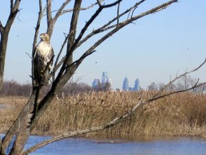
A hawk perches at John Heinz National Wildlife Refuge. Photo credit: Derik Pinsonneault, USFWS.
The John Heinz National Wildlife Refuge at Tinicum is located just minutes from downtown Philadelphia and is known for its rare tidal freshwater ecosystem and wild rice stands. The freshwater impoundment is a centerpiece of the refuge and attracts a large diversity and abundance of waterbirds. Located along the Atlantic Flyway, the refuge is considered an Important Bird Area by National Audubon (Cohen and Johnson 2004). Refuge staff have involved the impoundment in a number of bird monitoring schemes over the years including a regional USFWS study of impoundment management (Green et al. 2007), the International Shorebird Survey (ISS), and the International Waterbird Management and Monitoring (IWMM) program. The refuge (and the impoundment in particular) is a major birding destination – over 6,700 eBird checklists have been recorded from the Heinz impoundment hotspot tallying a total of 290 species. High counts of shorebirds (3,000 Semipalmated and 2,500 Least Sandpiper) and waterfowl (1,000 Northern Shoveler, Northern Pintail, and Green-winged Teal) are notable. The Red-bellied Turtle (Pseudemys rubriventris), a state-threatened species in Pennsylvania, is found in the impoundment.
The impoundment, which dates back to flood control efforts in the 18th century, was acquired by the USFWS from the City of Philadelphia in 1972. It is currently managed by refuge staff to support a variety of waterbirds. The primary management action is drawing down water levels to expose mudflats for migratory shorebirds during the late summer periods. Water levels are raised again in fall for migrating and wintering waterfowl (Green et al. 2007, Stoltz 2012).
Vulnerability
The embankment surrounding the impoundment is relatively low (~3-6 feet above mean high water) and was breached during several major storm events (e.g., Hurricane Floyd in 1999, and at least two others). Significant erosion has happened in recent years during high rainfall events: Hurricane Irene and Tropical Storm Lee in 2011. Hurricane Sandy in 2012 caused minor overtopping and erosion. The damage was repaired following each event. The main vulnerability for the Heinz impoundment is not necessarily storm surge from tidal waters as it is with many other coastal impoundments. Heavy rains can cause waters in adjacent Darby Creek to rise and enter the impoundment on the northern end of the impoundment,which then causes damage to the southern embankment as the water seeks an exit. The refuge is considering restoration measures which would allow freshwater tidal flows to more freely enter and exit the impoundment. Sea level rise is a threat to the freshwater marsh ecosystem at the site as the saltwater transition line occurs about two and a half miles downstream.
Human Value
Heinz is known as America’s First Urban National Wildlife Refuge and receives over 100,000 visitors per year, nearly three-quarters of which are local residents (Stolz 2012). The majority of these visitors are visiting the trails surrounding the impoundment for non-consumptive purposes such as hiking, photography, and wildlife observation. Staff provide programming and weekend walks to up to 13,000 people annually, and up to 8,000 school children visit on class trips. The refuge hosts its own summer camp and is visited by an additional 50-60 outside summer camps during an average year.
Acknowledgements
We are grateful to Lamar Gore and Brendalee Phillips (Heinz NWR) for providing much of the information contained on this page.
Literature Resources
Below is a list of scholarly articles describing research occurring at or near the impoundment:
Bell, B., J. R. Spotila, and J. Congdon. 2006. High incidence of deformity in aquatic turtles in the John Heinz National Wildlife Refuge. Environmental Pollution 142:457-465.
Cohen, M., and J. Johnson. Pennsylvania Important Bird Area #73: John Heinz National Wildlife Refuge at Tinicum Phase 1 Report. New York, New York: National Audubon; 2004.
Gorton, G. Tinicum’s Most Famous Bird, 35 Years Later. Philadelphia: Delaware Valley Ornithological Club; 2015.
Green, A., J. Lyons, M. Runge, W. Kendall, H. Laskowski, S. Lor, and S. Guiteras. Timing of impoundment drawdowns and impact on waterbird, invertebrate, and vegetation communities within managed wetlands, Study manual – Final version field season 2007. Laurel, Maryland: USGS Patuxent Wildlife Research Center; 2007.
Green, A. W., W. L. Kendall, H. P. Laskowski, J. E. Lyons, L. Socheata, and M. C. Runge. Draft version of the USFWS R3/R5 Regional Impoundment Study. Washington, D. C.: U. S. Fish and Wildlife Service; 2008.
Harding, J. J. 1980. Birding the Delaware Valley Region: A Comprehensive Guide to Birdwatching in Southeastern Pennsylvania, Central and Southern New Jersey, and Northcentral Delaware. Temple University Press, Philadelphia, Pennsylvania.
Miller, J. C. 2001. Update of the Status of Birds in the John Heinz National Wildlife Refuge at Tinicium and Adjacent Areas in Philadelphia and Delaware Counties, Pennsylvania 1995-2001. Cassinia 69:27-31.
Stolz, G., et al., John Heinz National Wildlife Refuge at Tinicum, Comprehensive Conservation Plan. Washington, D. C.: U. S. Fish and Wildlife Service; 2012.

Site Description
State: Delaware
County: New Castle
Ownership: State
Impoundments
Lang Marsh: 195 acres
Ecology and Management
Lang Marsh is a brackish impoundment located near the town of Port Penn in northern Delaware. It fronts on Delaware Bay, just south of the large, privately-owned Thousand-acre Marsh impoundment. The impoundment was constructed in the 1950s and was owned by the Lang family before its transfer to the state of Delaware. It is now part of Augustine State Wildlife Area. It goes by the alternate names of Canadas Beach impoundment (Chan & Schulte 2003) and Port Penn impoundment (on eBird.org). The impoundment is currently managed by Delaware Department of Natural Resources and Environmental Control (DNREC) primarily to support waterfowl and shorebirds. Nesting structures are erected on site, and formerly water levels were manipulated to expose mudflats during shorebird migration. Water control capabilities were lost in recent years due to deteriorating equipment. According to eBird, 205 bird species have been observed at the site, including sizeable numbers of shorebirds: a high count in 2015 tallied 1,100 Semi-palmated Sandpipers using the impoundment.
Vulnerability
The Lang Marsh impoundment has experienced severe damage (breached) at least twice in the last 25 years: once during Hurricane Sandy and once in a subsequent nor’easter. The water control structures are currently non-functional and this formerly freshwater impoundment has become more brackish in recent years due to saltwater infiltration. Phragmites growth has increased as a result. Overall, the impoundment is highly vulnerable to sea level rise.
Human Value
There is no official visitor use data for Lang Marsh, although it is frequented by birders. Over 440 birding checklists have been submitted to eBird.org (as of January 2017).
Literature Resources
Below is a list of articles describing research occurring at or near the impoundments:
Catts, W. P., and T. Mancl. “To keep the banks, dams and sluices in repair”: an historical context for Delaware River dikes, New Castle County, Delaware. Dover, Delaware: Delaware Department of Natural Resources and Environmental Control; 2013.
Chan, S., and S. Shulte. A Plan for Monitoring Shorebirds During the Non-breeding Season in Bird Monitoring Region Delaware – BCR 30. Manomet, Massachusetts: Manomet Center for Conservation Sciences; 2003.
DDNREC [Delaware Department of Natural Resources and Environmental Control]. Northern Delaware Wetland Rehabilitation Program. http://www.dnrec.state.de.us/fw/intmrmt.htm. Dover, Delaware: Delaware Department of Natural Resources and Environmental Control; 2001.
Meredith, W. H., T. J. Moran, and R. E. Meadows. Managing Delaware’s Coastal Wetlands for Biodiversity. Dover, Delaware: Delaware Department of Natural Resources and Environmental Control; 2002.
Parsons, K. C. 2002. Integrated management of waterbird habitats at impounded wetlands in Delaware Bay, USA. Waterbirds 25:25-41.

Site Description
State: New Jersey
County: Atlantic and Cape May
Ownership: State
Impoundments
Corbin City Impoundment #1: 126 acres
Corbin City Impoundment #2: 272 acres
Corbin City Impoundment #3: 303 acres
Tuckahoe Impoundment #1: 46 acres
Tuckahoe Impoundment #2: 186 acres
Tuckahoe Impoundment #3: 42 acres
Ecology and Management

The Lester G. MacNamara WMA is important for wintering raptors like this Rough-legged Hawk. Photo credit: Jim Gilbert.
Lester G. MacNamara Wildlife Management Area (WMA) is a state-owned refuge encompassing 34,000 acres of saltmarsh along the Tuckahoe and Great Egg Harbor Rivers. Two groups of three impoundments, about 40 to 300 acres each in size, are located along the landward edge of the marsh. A sand road along the top of the dike makes them a highlight for wildlife viewing opportunities in the refuge. The WMA is on the New Jersey Audubon Important Bird Area list due to its concentrations of state-listed marsh bird species. For example, both King Rail (NJ threatened) and Black Rail (NJ endangered) have been documented in the marshes in or near the impoundments (the latter in 2015). Waterfowl can be abundant during migration with high counts of 3,000 Green-winged Teal and 1,000 Northern Pintails reported to eBird.org. Tundra Swans commonly winter in the impoundments. Shorebirds are common too, especially in units that are open to the tides and therefore have exposed mudflats. The site has participated in the Integrated Waterbird Management and Monitoring (IWMM) program.
The impoundments were constructed to benefit migratory waterfowl in 1943 under the direction of New Jersey’s Superintendent of Wildlife Management, Lester G. MacNamara (MacNamara 1949). In recent years the eight 1990’s-era water control structures in the impoundments have ceased to function, so water levels are kept full or allowed to rise and fall with the tides. A major phragmites control effort was undertaken in 2003 along with partners including the US Fish and Wildlife Service and Ducks Unlimited. There are plans for major repairs to the dikes and water control structures, and for the resuming of multi-species water level management, in the near future.
Vulnerability
The current dikes are fairly low (about 3 feet above mean high water level), so sea level rise is a major concern. One of the six impoundments (the southernmost) had been breached since before 2000 and remains so. Otherwise, only minor erosion had been encountered before Hurricane Sandy in 2012 which caused unprecedented damage. Two of the impoundments in the northern (“Corbin City”) cluster were breached in three locations. Temporary repairs were put into place. The full cost of repairing and reinforcing the dikes and replacing the water control structures was estimated at $1.5 million (ALS 2012). Some of these upgrades are scheduled to occur in the near future.
Human Value
The impoundments and the refuge are in a fairly remote and rural area, but they are nevertheless visited often by birders and photographers drawn to the rare species found on the site. Fishermen and drivers looking for general scenery also travel the sand road along the dike.
Acknowledgements
We are grateful to Dave Golden and Jason Hearson (NJDEP DFW) for providing information used on this page.
Literature Resources
Below is a list of scholarly articles describing research occurring at or near the impoundments:
ALS [American Litoral Society]. Assessing the impacts of Hurricane Sandy on coastal habitats. Highlands, New Jersey: American Littoral Society; 2012.
Bauers, S. 2013. Report finds $50M in post-Sandy bird habitat projects needed. Philadelphia Inquirer / Philly.com January 3, 2013:1.
Cramer, D. Estimating habitat carrying capacity for American black ducks wintering in southern New Jersey. University of Delaware; 2009.
MacNamara, L. G. Salt-marsh development at Tuckahoe, New Jersey, p. 100-107 in Transasctions of the 14th North American Wildlife Conference.
Investment Building, Washington, D. C.: Wildlife Management Institute; 1949.
NJDEP [New Jersey Department of Environmental Protection]. Places to Fish: Ponds, Lakes, and Reservoirs. http://www.state.nj.us/dep/fgw/fishplc.htm Accessed 2015:1.
USFWS [United States Fish and Wildlife Service]. Lester G. MacNamara WMA Restoration Project (Factsheet). Pleasantville, New Jersey: U.S. Department of the Interior, Fish and Wildlife Service, New Jersey Field Office; 2003.

Site Description
State: Delaware
County: Kent
Ownership: State
Impoundments
Little Creek Center: 146 acres
Little Creek North (Port Mahon): 424 acres
Little Creek South: 472 acres
Little Creek Southwest: 155 acres
Ecology and Management
Little Creek State Wildlife Area (SWA) is situated along the Delaware Bay directly south of Bombay Hook NWF. This site contains four impoundments with the main two being Port Mahon (aka Little Creek North) in the northern section of the SWA and Little Creek (aka Little Creek South) in the south. The four impoundments together provide a total of over 1000 acres of habitat for shorebirds and migratory waterfowl. The site is managed by the DE Division of Fish and Wildlife. This area supports a large numbers of birds with counts of over 5,000 recorded for Dunlin, Semipalmated Sandpiper, and Snow Goose as well as counts of over 1,000 for many other species of shorebirds and waterfowl.
Vulnerability
Little Creek SWA is part of a large effort by Delaware Department of Natural Resources and Environmental Control (DNREC) to enhance the resilience of their coastal impoundments. The dikes the surrounding the impoundments at Little Creek SWA will be repaired and improved to provide resilience against the impacts of climate change for another thirty years.
Human Value
There is no human use data on Little Creek SWA.
Literature Resources
Below is a list of articles describing research occurring at or near the impoundments:
Breese, G., K. Kalasz, J. Lyons, C. Boal, J. Clark, M. DiBona, R. Hossler, B. Jones, B. Meadows, M. Stroeh, B. Wilson, and M. Runge. Structured decision making for coastal managed wetlands in Delaware. Shepherdstown, West Virginia: United States Fish and Wildlife Service, National Conservation Training Center; 2010.
Chamberlain, E. B. A survey of the marshes of Delaware. Dover, Delaware: The State of Delaware, Board of Game and Fish Commissioners; 1951.
Chan, S., and S. Shulte. A Plan for Monitoring Shorebirds During the Non-breeding Season in Bird Monitoring Region Delaware – BCR 30. Manomet, Massachusetts: Manomet Center for Conservation Sciences; 2003.
Harding, J. J. 1980. Birding the Delaware Valley Region: A Comprehensive Guide to Birdwatching in Southeastern Pennsylvania, Central and Southern New Jersey, and Northcentral Delaware. Temple University Press, Philadelphia, Pennsylvania.
Holgersen, N. E. 1971. Black-necked Stilt nesting in Delaware. The Wilson Bulletin 83:100-100.
Hossler, R., K. Bennett, and A. Kane. Coastal Impoundment Decision Making. A presentation given at Connect, Collaborate, and Conserve in an Era of Changing Landscapes: An Interactive Training on State Wildlife Action Plans, June 4-6, 2013. Washington, D.C.: Association of Fish & Wildlife Agencies.
Kneidel, A. 2014. Little Creek: Delaware’s Shorebird Hotspot for 2014.
http://www.nemesisbird.com/birding/little-creek-delawares-shorebird-hotspot-2014/ October 9, 2014:1.
Lesser, F. H. 1963. Waterbirds of Little Creek. Cassinia 47:22-32.
Lunt, D. C. 1986. Taylors Gut: In the Delaware State. Middle Atlantic Press, Wilmington, Delaware.
Meredith, W. H., T. J. Moran, and R. E. Meadows. Managing Delaware’s Coastal Wetlands for Biodiversity. Dover, Delaware: Delaware Department of Natural Resources and Environmental Control; 2002.
Murray, M. 2014. Delaware gets millions to help beaches, wetlands. Delaware Online June 8, 2014:1.
Murray, M., and J. Montgomery. 2012. Marsh impoundments create questions on future responses by state officials. Delaware Online October 23, 2012:1.
Stocks, K. I., and J. F. Grassle. 2003. Benthic macrofaunal communities in partially impounded salt marshes in Delaware: comparisons with natural marshes and responses to sediment exposure. Estuaries 26:777-789.
Wayne, W. J., and T. E. Roberts. 1972. The Summer Scene. The Delmarva Ornithologist 7:4-6.
Whitman, W. R. Restoration of migratory and wintering waterfowl habitat in coastal impoundments of Delaware. A paper presented at the Symposium on Habitat Management for Migrating and Wintering Waterfowl in North America, January 24-28, 1988, Jackson, Mississippi. Dover, Delaware: DNREC Division of Fish & Wildlife; 1988.

Site Description
State: New Jersey
County: Ocean
Ownership: State
Impoundments
Manahawkin Center: 12 acres
Manahawkin North: 56 acres
Manahawkin Northwest: 31 acres
Manahawkin South Lower: 14 acres
Manahawkin South Upper: 13 acres
Manahawkin West: 32 acres
Ecology and Management
The Manahawkin impoundments were originally built in 1961 by the NJ Division of Fish and Wildlife and the Ocean County New Jersey Mosquito Extermination Commission. Their original purpose was both mosquito control and waterfowl production, and they were fitted with water control pumps to manage water levels. The pumps eventually fell into disrepair, and while they were considered for replacement in the early 2000s, it was not found to be cost effective. Today the impoundments contain a mix of open water and marsh grasses, with shrubs and small trees on the dikes. They attract a variety of waterbirds, and the Manahawkin Wildlife Management Area in which they occur is considered a New Jersey Important Bird Area. Water levels are not currently managed in the impoundments and there are no imminent plans for restoration.
Vulnerability
These impoundments are vulnerable to overtopping and erosion as the dikes average only about 2 feet above mean high water level. However, they are also somewhat protected by a large expanse of salt marsh. Woody vegetation and muskrat burrows may pose structural problems to the dikes.
Human Value
The Manahawkin Wildlife Management Area is a popular birding spot in central New Jersey, especially the road from which the impoundments can be viewed.
Acknowledgements
We are grateful to Joseph Schmidt (Ocean County New Jersey Mosquito Extermination Commission), Peter Winkler (NJDFW), and Dave Golden (NJDFW) for providing helpful information used on this page.
Literature Resources
Below is a list of articles describing research occurring at or near the impoundments:
Ruber, E., A. Gilbert, P. Montagna, G. Gillis, and E. Cummings. 1994. Effects of impounding coastal salt marsh for mosquito control on microcrustacean populations. Hydrobiologia 292/293:497-503.

Site Description
State: Virginia
County: Fairfax
Ownership: Federal
Impoundments
Little Marsh: 58 acres
Little Marsh Road: 2 acres
Ecology and Management
Elizabeth Hartwell Mason Neck National Wildlife Refuge (NWR) is part of the Potomac River NWR Complex in northern Virginia, 14 miles from Washington, D.C. It was established in 1969 as the first NWR specifically created to protect an endangered species, the Bald Eagle. The main impoundment on the site (Little Marsh) still frequently hosts foraging Bald Eagles, as well as other fish-eating species (Weller 2011). Little Marsh also contains one of the largest Great Blue Heron rookeries in Virginia. Other breeding species include Least Bittern, Black-crowned Night-heron, Wood Duck and Hooded Merganser. Water level management includes drawing levels down as low as possible in June and July to improve foraging conditions for young Bald Eagles and Great Blue Herons. Sedimentation and encroachment of woody vegetation have been recurring management challenges in the impoundments.
Vulnerability
“In the past, large storms have overtopped the dike threatening to damage or wash it out.”
-(Weller 2011)
The Little Marsh and Little Marsh Road impoundments both occur on a tidal river (the Potomac), but as they are both essentially dammed tributaries, they may be most susceptible to overtopping due to flooding during large rainfall events.
Human Value
“Mason Neck Refuge is located within driving distance of approximately 10 million residents of Virginia, Maryland, and Washington, D.C.”
– (Weller 2011)
Approximately 19,000 people per year visit Mason Neck NWR, but foot and boat access is currently prohibited at both impoundments to avoid disturbing sensitive species.
Literature Resources
Below is a list of articles describing research occurring at or near the impoundments:
Iwanowicz, L., V. Blazer, A. Pinkney, C. Guy, A. Major, K. Munney, S. Mierzykowski, S. Lingenfelser, A. Secord, and K. Patnode. 2016. Evidence of estrogenic endocrine disruption in smallmouth and largemouth bass inhabiting Northeast US national wildlife refuge waters: A reconnaissance study. Ecotoxicology and environmental safety 124:50-59.
Johnson, K. N., A. E. Pinkney, M. J. Melancon, and D. J. Hoffman. Investigation of biochemical indicators of contaminant exposure in great blue herons (Ardea herodias) from Mason Neck NWR. Annapolis, Maryland: U.S. Fish and Wildlife Service, Chesapeake Bay Field Office; 2001. Report nr CBFO-C01-02.
Jones, G. S., and M. K. Klimkiewicz. 1971. Mammals of Mason Neck. Atlantic Naturalist 26:108-114.
Klimkiewicz, M. K. 1970. Autumn Migration Flyway One Mason-Neck. Atlantic Naturalist 25:160-164.
Orr, J., and L. Mendoza. 2011. Herpetofaunal Survey of Mason Neck State Park and Mason Neck National Wildlife Refuge. Catesbeiana 31:59-72.
Weller, G. J. Elizabeth Hartwell Mason Neck National Wildlife Refuge and Featherstone National Wildlife Refuge Comprehensive Conservation Plan. Hadley, MA: US Fish and Wildlife Service; 2011.
Witt, J. W. 2006. Great Blue Heron productivity at Mason Neck National Wildlife refuge in Northern Virginia, and the potential impacts of weather during a 13-year interval. Waterbirds 29:345-349.

Site Description
State: Maine
County: Washington
Ownership: Federal
Impoundments
50 impoundments
Ecology and Management
Moosehorn National Wildlife Refuge in northern Maine contains over 50 impoundments, but only one, the Nat Smith impoundment in the Edmunds division, fronts on tidal waters. It is described by the USFWS as a “former tidal marsh” with “abundant stands of wild rice.” The impoundment is used by shorebirds, wading birds, and waterfowl, especially during fall migration when it can host over 100 Wood and Black Ducks. Waterfowl hunting is not permitted at the impoundment due to its proximity to houses.
Vulnerability
The impoundment is in a relatively sheltered location among a network of narrow bays approximately 12 miles inland from where the Lubec Channel empties into the Atlantic at the Canadian border. The dike that forms the impoundment is approximately 7 feet above mean high water.
Human Value
Visitation data for Moosehorn NWR is unavailable. The impoundment is in a rural area, near the town of Edmunds, ME and Cobscook Bay State Park.
Literature Resources
Below is a list of articles describing research occurring at or near the impoundment:
Ducks Unlimited. Moosehorn National Wildlife Refuge Howard Mill and Upper Magurrewock Impoundment Enhancement. http://www.ducks.org/maine/maine-projects/maine-moosehorn-national-wildlife-refuge 2015:1.
Fefer, S. I. Waterfowl populations as Related to Habitat Changes in Bog Wetlands of the Moosehorn National Wildlife Refuge. Orono, Maine: Life Sciences and Agriculture Experiment Station, University of Maine at Orono; 1977. Report nr 86.
Frazer, C., J. R. Longcore, and D. G. McAuley. 1990. Home range and movements of postfledging American black ducks in eastern Maine. Canadian Journal of Zoology 68:1288-1291
.
Frazer, C., J. R. Longcore, and D. G. McAuley. 1990. Habitat use by postfledging American black ducks in Maine and New Brunswick. The Journal of Wildlife Management 54:451-459.
Green, A., J. Lyons, M. Runge, W. Kendall, H. Laskowski, S. Lor, and S. Guiteras. Timing of impoundment drawdowns and impact on waterbird, invertebrate, and vegetation communities within managed wetlands, Study manual – Final version field season 2007. Laurel, Maryland: USGS Patuxent Wildlife Research Center; 2007.
Green, A. W., W. L. Kendall, H. P. Laskowski, J. E. Lyons, L. Socheata, and M. C. Runge. Draft version of the USFWS R3/R5 Regional Impoundment Study. Washington, D. C.: U. S. Fish and Wildlife Service; 2008.
Hierl, L. A., C. S. Loftin, J. R. Longcore, D. G. McAuley, and D. L. Urban. 2007. A multivariate assessment of changes in wetland habitat for waterbirds at Moosehorn National Wildlife Refuge, Maine, USA. Wetlands 27:141-152.
Longcore, J. R. Effects of impoundment management on vegetation change on Moosehorn NWR wetlands. Science Brief PWRC 2003-30. Orono, Maine: USGS Patuxent Wildlife Research Center; 2003.
McAuley, D. G., and J. R. Longcore. 1988. Survival of juvenile ring-necked ducks on wetlands of different pH. The Journal of Wildlife Management 52:169-176.
Mendall, H. L. 1949. Breeding ground improvements for waterfowl in Maine. Wildlife Management Institute, Washington, DC.
MNWR [Moosehorn National Wildlife Refuge]. 2014. Moosehorn National Wildlife Refuge, Resource Management. http://www.fws.gov/refuge/Moosehorn/what_we_do/resource_management.html Accessed 2016.
Robertson, E. P. Responses of Rail Productivity to Water Level Variability and Factors Affecting Rail Broadcast Survey Results. The University of Maine; 2012.
Tudor, L. Migratory Shorebird Assessment. Augusta, Maine: Maine Department of Inland Fisheries and Wildlife, Wildlife Resource Assessment Section, Bird Group; 2000.

Site Description
State: Massachusetts
County: Essex
Ownership: Federal
Impoundments
North Pool: 100 acres
Bill Forward Pool: 65 acres
Stage Island Pool: 100 acres
Ecology and Management

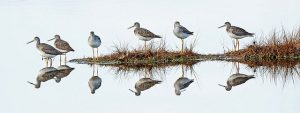
Shorebirds staging at Parker River NWR. Photo: Ranger Poole, USFWS
The impoundments at Parker River National Wildlife Refuge provide critical habitat to thousands of shorebirds, wading birds and waterfowl. The refuge and its impoundments are located within the Great Marsh, the largest contiguous salt marsh in New England, an Important Bird Area of global significance, and a WHSRN site of regional importance. During migration, the area as a whole supports over 67,000 shorebirds representing 30 different species. When managed, Bill Forward and Stage Island Impoundments provide foraging and roosting habitat to high concentrations of shorebirds during migration. North Pool is primarily managed for breeding marsh and wading birds. Parker River National Wildlife Refuge had used the Integrated Waterbird Management and Monitoring (IWMM) protocol to assess bird use of their impoundments. Even though they no longer participate in IWMM, many years of their data are still in the database, and summarized in the Annual Habitat Work Plans. According to data from eBird, 213 species of birds have been observed at Bill Forward Pool, 235 species at Stage Island Pool and 165 species at North pool. High counts from the Hellcat Dike (which separates North pool and the Bill Forward Pool) include 600 Black-bellied Plovers, 1,500 Semipalmated Plovers, 215 Greater Yellowlegs, and 2,285 Semipalmated Sandpipers. Rare and endangered species also nest in the impoundments during the summer months. Breeding data from surveys done from 2005-2011 reveal that breeding of Least Bittern and American Bittern were in the North Pool. Historically, Pied-billed Grebes have also likely bred in the North Pool. All three species are on the Massachusetts endangered species list.

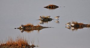
Sandpipers at Parker River National Wildlife Refuge. Photo credit: Matt Poole/USFWS.
Like many impoundments constructed in the 1940s and 1950s, the impoundments at Parker River NWR were constructed to benefit Black Ducks. However the focus of the impoundments has shifted to a multiple species approach. Current management practices are designed to provide habitat for wading birds, waterfowl, breeding birds, and migratory shorebirds. North Pool is kept primarily as fresh water habitat and Bill Forward and Stage Island as brackish water (10-15% salinity). Water levels are typically held high in all three impoundments during the summer breeding season, but during spring and fall migration the water level is drawn down in Stage Island and Bill Forward to provide migratory stopover habitat for shorebirds. Invasive species (Phragmites) management is also considered a high priority in these impoundments to help create habitat more suitable for shorebirds and waterfowl. Management is designed to increase rushes, sedges, and mudflats – ideal feeding areas for waterfowl and shorebirds. Invasive plants are primarily controlled by manipulating water levels and by seasonal mowing.
Vulnerability
All three impoundments at Parker River NWR are at, close to, or below mean high water. However the impoundments are sheltered from storm-driven flooding. On the ocean side, large vegetated dunes prevent storm surge from reaching the impoundments. On the bay side, vast stretches of high and low marsh reduce the likelihood of flooding. According to refuge staff, none of the impoundments have ever been impacted by storm-driven erosion or overtopping. With the predicted change in Plum Island Sound, higher vulnerability is expected in the future, with enlarged open water and narrower salt marsh.
Human Value
Approximately 240-250 thousand people visit the refuge each year. According to a visitor study conducted in 2010/2011, the top activity reported by those surveyed were bird watching (67%) and wildlife observation (61%). Although it’s impossible to know where exactly visitors spent their time watching birds and wildlife, it is more than likely that a majority of these folks went to one or more of the refuge’s impoundments where birds and wildlife are most easily visible.
Acknowledgements
We are grateful to Nancy Pau and Bill Peterson (Park River NWR) for providing helpful information used on this page.
Literature Resources
Below is a list of articles describing research occurring at or near the impoundments:
Berry, J. Letter to Parker River NWR. Essex County Ornithological Club; 2003.
Carson, R. Parker River: A National Wildlife Refuge. Washington, D.C.: United States Fish and Wildlife Service; 1947. 15 p.
Green, A., J. Lyons, M. Runge, W. Kendall, H. Laskowski, S. Lor, and S. Guiteras. Timing of impoundment drawdowns and impact on waterbird, invertebrate, and vegetation communities within managed wetlands, Study manual – Final version field season 2007. Laurel, Maryland: USGS Patuxent Wildlife Research Center; 2007.
Green, A. W., W. L. Kendall, H. P. Laskowski, J. E. Lyons, L. Socheata, and M. C. Runge. Draft version of the USFWS R3/R5 Regional Impoundment Study. Washington, D. C.: U. S. Fish and Wildlife Service; 2008.
Hagar, J. A. 1945. Parker River National Wildlife Refuge: The Case for Revision of Plans. Massachusetts Department of Conservation, Boston, Massachusetts.
PRNWR [Parker River National Wildlife Refuge]. 2013. Resource Management, Parker River National Wildlife Refuge. http://www.fws.gov/refuge/Parker_River/what_we_do/resource_management.html Accessed 2015:1.
Ruber, E., A. Gilbert, P. Montagna, G. Gillis, and E. Cummings. 1994. Effects of impounding coastal salt marsh for mosquito control on microcrustacean populations. Hydrobiologia 292/293:497-503.
Windingstad, R. M., and L. S. Hinds III. 1987. Lead poisoning in Canada geese on plum Island, Massachusetts. Journal of wildlife diseases 23:438-442.

Site Description
State: Delaware
County: Sussex
Ownership: Federal
Impoundments
Unit 2: 1555 acres
Unit 3: 3501 acres
Unit 4: 145 acres
Ecology and Management
Prime Hook National Wildlife Refuge has three coastal impoundments totaling 4,200 acres of freshwater wetland habitat that undergoing a managed transition to salt marsh habitats. Due to Prime Hook’s strategic location on the Delaware Bay, the refuge has national conservation significance as a designated RAMSAR Wetland of International Significance Site (1999), American Bird Conservancy-Important Bird Area (2000), and a Western Hemisphere Shorebird Reserve Network site (1986).

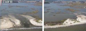
Breaches to Unit II impoundment.
After experiencing numerous breaches to the dunes which separate Units I & II in 2006, 2008, and 2009 the last of which resulted in the loss of over 1,000 acres of marsh, refuge staff began to explore options to allow the freshwater impoundments to transition to salt marsh. As this process was going on Hurricane Sandy caused two more breaches in Unit II. Based on extensive hydrodynamic modelling as well as public outreach Prime Hook NWR decided to move forward with a two-phase restoration of all impoundments to the original salt marsh habitats. The first phase was recently completed with a large-scale nourishment of the dune systems to protect the impoundments in the short term. The second phase is ongoing and includes the creation of tidal channels to improve circulation throughout the refuge and allow the impoundments to begin their ecological transition.
Vulnerability
As the repeated breaches have shown the impoundments are highly vulnerable to extreme storms and sea-level rise. The transition to salt marsh will result in habitats that are more resilient to these impacts of climate change. Additionally, the improved water circulation that will be achieved through the restoration efforts will decrease flooding in communities and the marsh vegetation will buffer the effects of future storm surge.
Human Value
Prime Hook NWR receives approximately 85,000 visitors every year, most of whom come to observe wildlife. The refuge also hosts a number tours, lectures, festivals and other educational and community events throughout the year. Prime Hook NWR has partnered with the University of Delaware on a monitoring program and also host education trips for K-12 students as well as having staff visit local schools.
Literature Resources
Below is a list of articles describing research occurring at or near the impoundments:
AFSBSPT [Atlantic Flyway Shorebird Business Strategy Planning Team]. Hurricane Sandy Rapid Assessment – Final Report. Manomet, MA: Manomet Center for Conservation Sciences; 2013.
ALS [American Litoral Society]. Assessing the impacts of Hurricane Sandy on coastal habitats. Highlands, New Jersey: American Littoral Society; 2012.
Anderson, J. T. 2006. Evaluating competing models for predicting seed mass of Walter’s millet. Wildlife Society Bulletin 34:156-158.
Breese, G., K. Kalasz, J. Lyons, C. Boal, J. Clark, M. DiBona, R. Hossler, B. Jones, B. Meadows, M. Stroeh, B. Wilson, and M. Runge. Structured decision making for coastal managed wetlands in Delaware. Shepherdstown, West Virginia: United States Fish and Wildlife Service, National Conservation Training Center; 2010.
Chamberlain, E. B. A survey of the marshes of Delaware. Dover, Delaware: The State of Delaware, Board of Game and Fish Commissioners; 1951.
Chan, S., and S. Shulte. A Plan for Monitoring Shorebirds During the Non-breeding Season in Bird Monitoring Region Delaware – BCR 30. Manomet, Massachusetts: Manomet Center for Conservation Sciences; 2003.
Conroy, M. J., G. R. Costanzo, and D. B. Stotts. 1989. Winter survival of female American black ducks on the Atlantic coast. The Journal of Wildlife Management 53:99-109.
Coppola, A. Prime Hook National Wildlife Refuge Comprehensive Conservation Plan. Hadley, Massachusetts: U.S. Department of the Interior, Fish and Wildlife Service; 2013.
DDNREC [Delaware Department of Natural Resources and Environmental Control]. Prime Hook NWR – Wetland management challenges – background information. Dover, Delaware: Delaware Department of Natural Resources and Environmental Control; 2012.
Erwin, R. M., D. K. Dawson, D. B. Stotts, L. S. McAllister, and P. H. Geissler. 1991. Open marsh water management in the mid-Atlantic region: aerial surveys of waterbird use. Wetlands 11:209-228.
Giroux, J., G. Gauthier, G. Costanzo, and A. Reed. 1998. Impact of geese on natural habitats. Pages 32-57 In Batt, B. D. J., editor. The Greater Snow Goose: report of the Arctic Goose Habitat Working Group, US Fish and Wildlife Service and Canadian Wildlife Service, Washington, DC and Ontario, Canada.
Green, A., J. Lyons, M. Runge, W. Kendall, H. Laskowski, S. Lor, and S. Guiteras. Timing of impoundment drawdowns and impact on waterbird, invertebrate, and vegetation communities within managed wetlands, Study manual – Final version field season 2007. Laurel, Maryland: USGS Patuxent Wildlife Research Center; 2007.
Green, A. W., W. L. Kendall, H. P. Laskowski, J. E. Lyons, L. Socheata, and M. C. Runge. Draft version of the USFWS R3/R5 Regional Impoundment Study. Washington, D. C.: U. S. Fish and Wildlife Service; 2008.
Hossler, R., K. Bennett, and A. Kane. Coastal Impoundment Decision Making. A presentation given at Connect, Collaborate, and Conserve in an Era of Changing Landscapes: An Interactive Training on State Wildlife Action Plans, June 4-6, 2013.
Washington, D.C.: Association of Fish & Wildlife Agencies.
IWMM [Integrated Waterbird Management and Monitoring Project]. Project Update – October 2010. http://iwmmprogram.ning.com/: Integrated Waterbird Management and Monitoring Project; 2010.
Kane, A. Practical guidance for coastal climate-smart conservation projects in the Northeast: Case examples for coastal impoundments and living shorelines. Montpelier, Vermont: National Wildlife Federation; 2011.
Murray, M., and J. Montgomery. 2012. Marsh impoundments create questions on future responses by state officials. Delaware Online October 23, 2012:1.
Neckles, H. A., J. E. Lyons, G. R. Guntenspergen, W. G. Shriver, and S. C. Adamowicz. 2015. Use of Structured Decision Making to Identify Monitoring Variables and Management Priorities for Salt Marsh Ecosystems. Estuaries and Coasts 38:1215-1232.
Sherfy, M. H., and R. L. Kirkpatrick. 2003. Invertebrate response to snow goose herbivory on moist-soil vegetation. Wetlands 23:236-249.
Sherfy, M. H., R. L. Kirkpatrick, and K. D. Richkus. 2000. Benthos core sampling and chironomid vertical distribution: implications for assessing shorebird food availability. Wildlife Society Bulletin 28:124-130.
Stevens, H., and A. Trembanis. 2012. Stabilizing the Forgotten Shore: Case Study from the Delaware Bay. Pages 267-281 In Cooper, J. A. G., and O. H. Pilkey, editors. Pitfalls of Shoreline Stabilization, Springer, New York.
Stroeh, M. Wetland management along a changing coast: a manager’s dilemma. A presentation given at the Delaware Wetlands Conference. Dover, Delaware: Delaware Department of Natural Resources and Environmental Control; 2012.
Wilson, B., D. Siok, C. Pinkerton, K. Smith, and B. Scarborough. Evaluating the Evolution of Natural Tidal and Managed Wetlands in Delaware. A presentation given at DE Wetlands Conference. Dover, Delaware: Delaware National Estuarine Research Reserve; 2012.

Site Description
State: Virginia
County: Virginia Beach
Ownership: State
Impoundments
13 impoundments: 177 total acres
Ecology and Management
The impoundments at Princess Anne WMA provide habitat to many waterfowl, shorebirds, saltmarsh birds, wading birds, and provides breeding and wintering habitat as well. This area also provides habitat for a range of invertebrates, fish, amphibians and reptiles, and mammals. The habitats that exist within the complex face a range of natural threats, including an ongoing invasion of Phragmites, which is treated on an annual/biennial basis. Erosion of outer marshes threatens integrity of the impoundment system, and nutria, Myocastor coypus, present a potential threat to dike and marsh integrity as does muskrat activity. The impoundments were constructed in the 1990’s and 2000’s primarily for waterfowl management, which is still the primary management focus today. Waterfowl are managed through moist soil management.
Vulnerability
The impoundments are relatively protected based on where they are located on the backside of Back Bay NWR. No damage has been documented to date.
Human Value
The impoundments neighbor Back Bay National Wildlife Refuge and are located in a relatively rural area with some residential development and a small airfield nearby. The city of Virginia Beach is about 40 miles north of the WMA. The area is primarily used for hunting and not educational purposes. No data exists on the number of visitors.
Acknowledgements
We are grateful to Steve Living, Virginia Department of Game and Inland Fisheries, for providing helpful information used on this page.
Literature Resources
Below is a list of articles describing research occurring at or near the impoundments:
Gooch, B. 2000. Enjoying Virginia Outdoors: A Guide to Wildlife Management Areas. University of Virginia Press, Charlottesville.
VDGIF [Virginia Division of Game and Inland Fisheries]. Princess Anne WMA. http://www.dgif.virginia.gov/wmas/detail.asp?pid=8 2015:1.
Weldon, A. Important bird areas (IBAs) in the commonwealth of Virginia. Virginia: National Audubon Society; 2007.

Site Description
State: New Jersey
County: Bergen
Ownership: State
Impoundments
Kingsland Impoundment: 79 acres
Ecology and Management

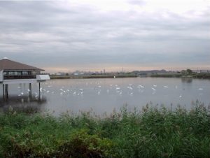
Egrets on the Kingsland Impoundment.
Richard W. DeKorte Park is located in the 19,485 acre urban wetland complex just outside of New York City known as the Hackensack Meadowlands. The region is classified an Important Bird Area (IBA) by New Jersey Audubon and is an area of conservation interest to the USFWS, mainly due to a high diversity of wetland birds and wildlife. The Kingsland Impoundment is a central feature of DeKorte Park and is one of the best places in the region to see concentrations of shorebirds, ducks, and long-legged wading birds. Staff biologists from the New Jersey Sports and Exposition Authority (formerly known as the Meadowlands Commission) monitor and carry out research on birds and other aspects of the environment at the site. The site has participated in the Integrated Waterbird Management and Monitoring (IWMM) program, and is frequented by birders who submit their observations on eBird.org. About 75 checklists have been submitted from the Marsh Discovery Trail which cuts diagonally across the impoundment, tallying 144 species. Over 4,400 checklists have been submitted from DeKorte Park more generally (many likely from the impoundment) recording a total of 265 species. High counts of 15,000 Semipalmated Sandpipers, 3,000 Least Sandpipers, and 600 Lesser Yellowlegs have been reported.
The impoundment was constructed incidentally and in stages as embankments were created for the Morris & Essex Railroad (1870s) and the TransCo gas pipeline (1948), with a county landfill forming the final boundary to the north. A sluice gate was installed by Bergen County in 1970 allowing some water control. Another water control structure was installed in 1992 by the owners of the Transco Pipeline at the request of the then NJ Meadowlands Commission (now the NJSEA). This allowed staff biologists to more easily manage water levels in the impoundment. Water levels were not regularly managed until 2007 when staff biologists began to actively manipulate levels to benefit a variety of waterbird species. Water levels are dropped during spring and fall to expose mudflats for migrating shorebirds. In fall and winter, water levels are kept high to provide habitat for waterfowl. The water source for the impoundment is the tidal (brackish) Hackensack River, via Kingsland Creek.
Vulnerability
The southern embankment (which contains the TransCo – Caldwell B 36 inch Lateral pipeline) was severely eroded during Hurricane Sandy, but was repaired and reinforced quickly by the pipeline owner. According to staff, the embankments been overtopped and have sustained some erosion before (notably a 1992 Nor’easter and 2011’s Hurricane Irene) but have never completely breached. The site is in a relatively sheltered location, approximately 0.5 miles inland from the Hackensack River. The top of the embankments are roughly 4-5 feet above the mean high water level.The southern embankment (which contains the TransCo – Caldwell B 36 inch Lateral pipeline) was severely eroded during Hurricane Sandy, but was repaired and reinforced quickly by the pipeline owner. According to staff, the embankments been overtopped and have sustained some erosion before (notably a 1992 Nor’easter and 2011’s Hurricane Irene) but have never completely breached. The site is in a relatively sheltered location, approximately 0.5 miles inland from the Hackensack River. The top of the embankments are roughly 4-5 feet above the mean high water level.
Human Value
An estimated 20,000 people visit DeKorte Park’s Kingsland Impoundment each year. In addition to being frequented by birders, the impoundment is also the site of regular nature programming, including weekly family nature walks and a daily grade-school educational program led by Ramapo College. The impoundment is a survey location in several New Jersey Audubon Citizen Science projects that involve birders in the monitoring of shorebird, heron, and marsh bird populations.
Acknowledgements
We are grateful to Brett Bragin and Michael Newhouse (NJSEA) for providing much of the information contained on this page.
Literature Resources
Below is a list of scholarly articles and reports describing environmental research occurring at or near the impoundment:
Anderson, T. K., and M. V. K. Sukhdeo. 2013. Qualitative community stability determines parasite establishment and richness in estuarine marshes. PeerJ 1:e92.
Kane, R., and D. Githens. Hackensack River migratory bird report: With recommendations for conservation. Bernardsville, New Jersey: New Jersey Audubon Society; 1997.
Kiviat, E., and K. MacDonald. Hackensack Meadowlands, New Jersey, biodiversity: A review and synthesis. Annandale, New York: Hudsonia, Ltd; 2002.
Kraus, M. L. 1989. Bioaccumulation of heavy metals in pre-fledgling tree swallows, Tachycineta bicolor. Bulletin of Environmental Contamination and Toxicology 43:407-414.
Mizrahi, D., N. Tsipoura, K. Witkowski, and M. Bisignano. Avian Abundance and Distribution in the New Jersey Meadowlands District: The Importance of Habitat, Landscape, and Disturbance. Bernardsville, New Jersey: New Jersey Audubon Society; 2007.
Tsipoura, N., J. Burger, R. Feltes, J. Yacabucci, D. Mizrahi, C. Jeitner, and M. Gochfeld. 2008. Metal concentrations in three species of passerine birds breeding in the Hackensack Meadowlands of New Jersey. Environmental research 107:218-228.
USACE [United States Army Corps of Engineers]. Meadowlands Environmental Site Investigation Compilation (MESIC), Hudson-Raritan Estuary, Hackensack Meadowlands, New Jersey. New York, New York: United States Army Corps of Engineers, New York District; 2004.
USFWS [United States Fish and Wildlife Service]. The Hackensack Meadowlands Initiative, Preliminary Conservation Planning. Pleasantville, New Jersey: U.S. Department of the Interior, Fish and Wildlife Service, New Jersey Field Office; 2007.

Site Description
State: Rhode Island
County: Newport
Ownership: Federal
Impoundments
Sachuest Point Impoundment: 29 acres
Ecology and Management
The impoundment at Sachuest Point National Wildlife Refuge was created in 2004 as part of a salt marsh creation and landfill remediation project. A water control structure installed in collaboration with Ducks Unlimited facilitates management of a mix of salt marsh, mudflat and salt panne habitats. Year round shorebird counts have been conducted in the restored marsh by volunteers. According to their website: “A total of 55 waterbird species and several birds of prey have been documented on the marsh since fall of 2004, with the most common species year-round being the three common gull species, followed by semipalmated plovers, double crested cormorant and semipalmated sandpiper.” This site participates in the International Shorebird Survey. The second highest wintering population of Harlequin Ducks on the Atlantic coast occurs off Sachuest Point (McGarigal 2002).
Vulnerability
The impounded area is separated from the ocean by a 100-foot-wide low dune on a dynamic coastline, and is therefore vulnerable to sea level rise, storms, and erosion.
Human Value
An estimated 65,000 people visit Sachuest NWR annually. The site is frequented by birders, particularly in the winter when high concentrations of sea ducks can be viewed from the point (McGarigal 2002).
Literature Resources
Below is a list of scholarly articles describing research occurring at or near the impoundments:
James-Pirri, M., K. Raposa, and J. Catena. 2001. Diet composition of mummichogs, Fundulus heteroclitus, from restoring and unrestricted regions of a New England (USA) salt marsh. Estuarine, Coastal and Shelf Science 53:205-213.
McGarigal, N. Comprehensive Conservation Plan: Sachuest Point National Wildlife Refuge. Charlestown, RI: US Fish and Wildlife Service; 2002.
McKinney, R. A., S. R. McWilliams, and M. A. Charpentier. 2006. Waterfowl–habitat associations during winter in an urban North Atlantic estuary. Biological Conservation 132:239-249.
Roman, C. T., K. B. Raposa, S. C. Adamowicz, M. James‐Pirri, and J. G. Catena. 2002. Quantifying vegetation and nekton response to tidal restoration of a New England salt marsh. Restoration Ecology 10:450-460.
USFWS [United States Fish and Wildlife Service]. Sachuest Point National Wildlife Refuge: Resource Management – Water Control Structure Installation. http://www.fws.gov/refuge/Sachuest_Point/what_we_do/resource_management.html 2016.

Site Description
State: New Jersey
County: Salem
Ownership: Federal
Impoundments
Tract 11: 64 acres
Tract 11C: 2 acres
Tract 11D Lighthouse Road: 92 acres
Tract 11D Christmas Tree Lane: 3 acres
Tract 18: 2 acres
Ecology and Management

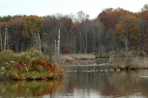
Tract 11D Lighthouse Road Impoundment provides habitat for a variety of birds. Photo Credit: USFWS.
Supawna Meadows National Wildlife Refuge (NWR) is located in southern New Jersey near the confluence of the Delaware and Salem Rivers. It is embedded within the ecologically significant landscape of the Delaware Bay Estuary, a region recognized by both the Western Hemisphere Shorebird Reserve Network and the Ramsar Convention. The refuge was established in 1974 “as property with particular value in carrying out the national migratory bird management program” (Braudis 2011). Five impoundments occur on the refuge. The Tract 11 impoundment was originally constructed as a waterfowl hunting pond and has become the most actively managed impoundment. This unit was part of a 2005-2007 study investigating optimal impoundment management within Regions 3 and 5 of the US Fish and Wildlife Service (Green et al. 2007, 2008). The 92-acre Tract 11D Lighthouse Road impoundment, along with the three smaller impoundments, were originally constructed as farm ponds but were later retrofitted with water control structures for use in wildlife management. The impoundments are host to many migrant shorebirds as well as Osprey, Bald Eagle and foraging herons and egrets from the nearby Pea Patch Island nesting colony (Parsons 2002). The impoundments are not readily accessible to birders so few eBird data exist. However, scientific monitoring efforts including the International Shorebird Survey (ISS), New Jersey Audubon’s Citizen Science shorebird counts, and a regional study of heron/egret foraging (Parsons 2002) have been carried out at the impoundments. Water levels were previously lowered for the spring and fall shorebird migrations, but they have not been actively managed since 2007 when fulltime staff were moved to the nearby Cape May National Wildlife Refuge. Water levels are currently (2016) kept high all year.
Vulnerability
The two largest impoundments are located at the back side of a large salt marsh which likely confers protection from wave energy. While some erosion (and subsequent repair/stabilization) has taken place over the last twenty years, only one impoundment (Tract 11 Lighthouse Road) has experienced overtopping and that was due to freshwater overflowing the dikes from the inside rather than a saltwater storm surge. No breaches of the dikes have been reported.
Human Value
Supawna NWR hosts about 15,000-20,000 visitors per year. A youth fishing derby and school group activities take place at the impoundments. The nearest towns are Pennsvile (pop. 13,400) and Salem (pop. 5,100).
Acknowledgements
We are grateful to Heidi Hanlon and Brian Braudis (Cape May and Supawna Meadows NWRs) for providing information used on this page.
Literature Resources
Below is a list of articles describing research occurring at or near the impoundments:
Anderson, J. T. 2006. Evaluating competing models for predicting seed mass of Walter’s millet. Wildlife Society Bulletin 34:156-158.
Augspurger, T., M. Roberts, C. R. Moore, and C. G. Day. Environmental contaminants investigation of Supawna Meadows National Wildlife Refuge: contamination and toxicity of mud creek sediments and heavy metal characterization of the refuge impoundment. Pleasantville, New Jersey: U.S. Department of the Interior, Fish and Wildlife Service, New Jersey Field Office; 1992.
Braudis, B. Supawna Meadows National Wildlife Refuge Comprehensive Conservation Plan. Cape May Court House, New Jersey: U.S. Department of the Interior, Fish and Wildlife Service; 2011.
Castelli, P. Hurricane Sandy resilience projects in New Jersey: Edwin B. Forsythe, Cape May and Supawna Meadows National Wildlife Refuges. Hadley, Massachusetts: Presentation given at the Hurricane Sandy Tidal Marsh Resiliency Coordination Workshop December 8-9, 2014.
Green, A., J. Lyons, M. Runge, W. Kendall, H. Laskowski, S. Lor, and S. Guiteras. Timing of impoundment drawdowns and impact on waterbird, invertebrate, and vegetation communities within managed wetlands, Study manual – Final version field season 2007. Laurel, Maryland: USGS Patuxent Wildlife Research Center; 2007.
Green, A. W., W. L. Kendall, H. P. Laskowski, J. E. Lyons, L. Socheata, and M. C. Runge. Draft version of the USFWS R3/R5 Regional Impoundment Study. Washington, D. C.: U. S. Fish and Wildlife Service; 2008.
Parsons, K. C. 2002. Integrated management of waterbird habitats at impounded wetlands in Delaware Bay, USA. Waterbirds 25:25-41.

Site Description
State: Delaware
County: Kent
Ownership: State
Impoundments
Taylor’s Gut: 131 acres
Ecology and Management
Taylor’s Gut is a freshwater impoundment located just north of Bombay Hook NWR in central Delaware. Ownership is mixed between private landowners and the Delaware Division of Fish of Wildlife (Woodland Beach State Wildlife Area). The site is managed primarily to support waterfowl in winter and shorebirds during the spring. According to eBird, 215 species have been observed at the site.
Vulnerability
Taylor’s Gut has experienced repeated damage from coastal storms and the dike surrounding the water control structure has been severely eroded. The state will be replacing the water control structure to enhance the resilience of this site to the impacts of climate change.
Human Value
There is no visitor use data for Taylor’s Gut, but the Delaware Fish and Wildlife owned Aquatic Resource Education Center borders the site and a provides environmental education opportunities for students and teachers.
Literature Resources
Below is a list of articles describing research occurring at or near the impoundment:
Chan, S., and S. Shulte. A Plan for Monitoring Shorebirds During the Non-breeding Season in Bird Monitoring Region Delaware – BCR 30. Manomet, Massachusetts: Manomet Center for Conservation Sciences; 2003.
Lunt, D. C. 1986. Taylors Gut: In the Delaware State. Middle Atlantic Press, Wilmington, Delaware.
Philipp, K. R. 2005. History of Delaware and New Jersey salt marsh restoration sites. Ecological Engineering 25:214-230.
Sussex Bird Club. Birding the Delaware Coast: Pickering Beach to Woodland Beach. Delaware: Sussex Bird Club; Undated.

Site Description
State: Delaware
County: Kent
Ownership: State
Impoundments
Logan Lane Center: 38 acres
Logan Lane North: 234 acres
Logan Lane South: 395 acres
Ecology and Management
Ted Harvey State Wildlife Area is located along the Delaware Bay approximately 10 miles southeast of Dover, DE. This area contains three impoundments totaling over 650 acres. The impoundments serve as important habitat for a number of shorebirds including red knots, semipalmated sandpiper, sanderling, dunlin, and short-billed dowitcher among others. The site is managed by Delaware Division of Fish and Wildlife and water levels are managed to provide habitat for shorebirds.
Vulnerability
Assessments have shown the impoundments at Ted Harvey SWA to be extremely vulnerable to sea-level rise and coastal storms. They are the focus of an ongoing effort to create two additional impoundments further upland in anticipation of rising sea-levels and the loss of management at the current impoundments. In the short term they are the focus of a larger Delaware Department of Natural Resources and Environmental Control (DNREC) initiative to improve the resilience of all their coastal impoundments and will repairing the levee, retrofitting the emergency spill way and replacing two water control structures.
Human Value
Visitor numbers are not available for Ted Harvey SWA but the area is mostly used for hunting, fishing and birding.
Literature Resources
Below is a list of articles describing research occurring at or near the impoundments:
Breese, G., K. Kalasz, J. Lyons, C. Boal, J. Clark, M. DiBona, R. Hossler, B. Jones, B. Meadows, M. Stroeh, B. Wilson, and M. Runge. Structured decision making for coastal managed wetlands in Delaware. Shepherdstown, West Virginia: United States Fish and Wildlife Service, National Conservation Training Center; 2010.
Chan, S., and S. Shulte. A Plan for Monitoring Shorebirds During the Non-breeding Season in Bird Monitoring Region Delaware – BCR 30. Manomet, Massachusetts: Manomet Center for Conservation Sciences; 2003.
Hossler, R., K. Bennett, and A. Kane. Coastal Impoundment Decision Making. A presentation given at Connect, Collaborate, and Conserve in an Era of Changing Landscapes: An Interactive Training on State Wildlife Action Plans, June 4-6, 2013. Washington, D.C.: Association of Fish & Wildlife Agencies.
Murray, M. 2014. Delaware gets millions to help beaches, wetlands. Delaware Online June 8, 2014:1.
Murray, M., and J. Montgomery. 2012. Marsh impoundments create questions on future responses by state officials. Delaware Online October 23, 2012:1.
Scarborough, R. W., and M. G. Mensinger. Hydrologic analysis of the Kitts Hummock Area. Dover, Delaware: Delaware National Estuarine Research Reserve; 2009.
Stocks, K. I., and J. F. Grassle. 2003. Benthic macrofaunal communities in partially impounded salt marshes in Delaware: comparisons with natural marshes and responses to sediment exposure. Estuaries 26:777-789.
Zimmerman, K. Roost Site Selection by Red Knots (Calidris canutus rufa) in Delaware Bay. University of Michigan; 2010.

Site Description
State: Delaware
County: New Castle
Ownership: Private
Impoundments
Thousand Acre Marsh: 1193 acres
Ecology and Management
Thousand Acre Marsh is an impoundment located along the Chesapeake & Delaware Canal in northern Delaware. As the name implies, the impounded area covers approximately 1,000 acres. The impoundment provides important habitat including for numerous herons from the nearby heron rookery at Pea Patch Island, the largest in the Mid-Atlantic region (Parsons 2002). According to eBird, the impoundment hosts over 200 bird species. The impoundment is considered a focal site in the International Shorebird Survey, a monitoring program for migratory shorebirds (Chan and Schulte 2003).
The ownership of Thousand Acre Marsh is complex. The water control structure is integrated in DE Rt. 9 and is owned by the Delaware Department of Transportation. The impoundment itself is owned by several landowners and DNREC. Due to this mix of ownership there is not a strategic management plan, but the impoundment is generally managed for waterfowl with high water levels in winter and an annual draw down in summer.
Vulnerability
Thousand Acre Marsh has experienced some storm damage including occasional damage to the water control structures. However the impoundment is bordered to the east by DE Rt. 9 and to the north by the C&D Canal, limiting the risk of severe damage and breaching from coastal storms.
Human Value
The site is a popular birding destination in Delaware. During hunting season Thousand Acre Marsh is a destination for both waterfowl and deer hunters.
Literature Resources
Below is a list of articles describing research occurring at or near the impoundments:
Catts, W. P., and T. Mancl. “To keep the banks, dams and sluices in repair”: an historical context for Delaware River dikes, New Castle County, Delaware. Dover, Delaware: Delaware Department of Natural Resources and Environmental Control; 2013.
Chan, S., and S. Shulte. A Plan for Monitoring Shorebirds During the Non-breeding Season in Bird Monitoring Region Delaware – BCR 30. Manomet, Massachusetts: Manomet Center for Conservation Sciences; 2003.
Parsons, K. C. 2002. Integrated management of waterbird habitats at impounded wetlands in Delaware Bay, USA. Waterbirds 25:25-41.

Site Description
State: Rhode Island
County: Washington
Ownership: Federal
Impoundments
Trustom Pond: 207 acres
Ecology and Management
Trustom Pond is a natural-formed coastal salt pond originally created by storm action in the 1700s. Until recently its water levels were actively managed by staff at the Trustom Pond National Wildlife Refuge, a unit of the Rhode Island NWR Complex. According to the Comprehensive Conservation Plan for the refuge (McGarigal and Vandemoer 2002): “…we mechanically breach the pond at least once a year, usually in early April, primarily to provide foraging habitat for piping plovers and other shorebirds.” Water levels are no longer actively managed at the pond, though habitat management still occurs for endangered species and others that depend on a coastal pond ecosystem.
Vulnerability
The pond is separated from the ocean by a long dune (~0.8 miles). According to the refuge’s Comprehensive Conservation Plan (McGarigal and Vandemoer 2002): “Natural breaching occurs … during periods of extreme high water.”
Human Value
The pond is surrounded by trails and is a popular site for bird watching, botany, and recreation.
Acknowledgements
We are grateful to Nick Ernst (USFWS) for providing information used on this page.
Literature Resources
Below is a list of scholarly articles describing research occurring at or near the impoundments:
Cohen, J., J. Barclay, A. Major, and J. Fisher. 2000. Wintering greater scaup as biomonitors of metal contamination in Federal Wildlife Refuges in the Long Island region. Archives of Environmental Contamination and Toxicology 38:83-92.
Harlin, M. M. 1995. Changes in major plant groups following nutrient enrichment. Pages 173-187 In McComb, A. J., editor. Eutrophic Shallow Estuaries and Lagoons, CRC Press, Inc., Boca Raton, Florida.
Lee, V., and S. Olsen. 1985. Eutrophication and management initiatives for the control of nutrient inputs to Rhode Island coastal lagoons. Estuaries 8:191-202.
McGarigal, N., and C. Vandemoer. Trustom Pond National Wildlife Refuge Comprehensive Conservation Plan. Hadley, Massachusetts: United States Fish and Wildlife Service, Northeast Regional Office; 2002.
Sims, S. A., J. R. Seavey, and C. G. Curtin. 2013. Room to move? Threatened shorebird habitat in the path of sea level rise—dynamic beaches, multiple users, and mixed ownership: a case study from Rhode Island, USA. Journal of Coastal Conservation 17:339-350.
Thorne-Miller, B., M. Harlin, G. Thursby, M. Brady-Campbell, and B. Dworetzky. 1983. Variations in the distribution and biomass of submerged macrophytes in five coastal lagoons in Rhode Island, USA. Botanica Marina 26:231-242.
Wood, R., and E. Palmatier. 1954. Macroscopic algae of the coastal ponds of Rhode Island. American Journal of Botany 41:135-142.

Site Description
State: New Jersey
County: Burlington
Ownership: State
Impoundments
Wading River East: 9 acres
Wading River West: 5 acres
Ecology and Management
Wading River Wildlife Management Area is a 159 acre state-owned parcel in Bass River Township, Burlington County, New Jersey. Two small impoundments occur in a restricted-use area of the WMA. They were restored in 2005-2007 with the help of the US Fish and Wildlife Service and Ducks Unlimited, including the removal of an extensive growth of invasive phragmites. Water levels are currently managed primarily for waterfowl, but also for shorebirds and wading birds (NJDEP 2016). A primary focus of the impoundments is to provide duck hunting experiences to youth facilitated by mentors from Ducks Unlimited and the New Jersey Waterfowler’s Association. No data on bird abundance exist for the site.
Vulnerability
The impoundments are embedded within a tidal wetland on the Wading River. They likely gain some protection from the marsh and the fact that they are far from the mouth of the river. The overtopping or breaching history of the impoundments is unknown.
Human Value
The impoundments are not open to the general public, but they do provide special mentored youth hunting opportunities at various times during the year (see above).
Acknowledgements
We are grateful to Dave Golden, Pete Winkler, and Jason Hearon (NJDEP DFW) for providing information used on this page.
Literature Resources
Below is a list of scholarly articles describing research occurring at or near the impoundments:
NJDEP [New Jersey Department of Environmental Protection]. Wading River WMA Special Use Area Youth Waterfowl Blinds and Mentoring Program. http://www.state.nj.us/dep/fgw/wadingriverblinds.htm Accessed 2016.

Site Description
State: New York
County: Suffolk
Ownership: Federal
Impoundments
Big Fish Creek Impoundment: 35 acres
Big Fish Creek Sub-impoundment: 7 acres
Ecology and Management
Wertheim National Wildlife Refuge encompasses 2,572 acres along the southern shore of Long Island and is part of the Long Island National Wildlife Refuge Complex. The lands were acquired in 1947 via the Migratory Bird Conservation Act and the Refuge Recreation Act (Long 2006). Two adjoining impoundments (totally over 70 acres) occur on the refuge. They were constructed in the 1980s along a tidal creek on the back side of a salt marsh fringing Long Island Sound. Water levels are currently managed by draining slowly in the spring to expose mudflats for migrating shorebirds and shallow waters for herons, and then raising levels slowly in the fall for the wintering waterfowl migration. Historically, wildlife food plants such as millet were planted in the impoundments. Phragmites encroachment is a concern and is actively managed by refuge staff.
The impoundments are host to a wide assortment of migrant shorebirds, long-legged waders, and waterfowl during migration (Long 2006). Refuge biologists have also documented several state-listed birds using the impoundments, including Northern Harrier, Pied-billed Grebe, Peregrine Falcon, Bald Eagle, Common Tern, and Least Tern. At least one Federally-listed species (Long-eared Bat) has been documented on the site.
Vulnerability
Both impoundments are subjected to flooding and occasional saltwater intrusion during exceptionally strong storms and high tides. For example, during Hurricane Sandy, the dikes overtopped leading to significant erosion. Wertheim, along with several other National Wildlife Refuge sites in the Northeast, is participating in a regional USFWS effort to assess impoundment vulnerability.
Human Value
The Long Island Wildlife Refuge Complex, of which Wertheim NWR is a part, is within a 2 hour drive of nearly 14 million people and is visited by nearly 500,000 people per year (Long 2006). The exact number of annual visitors to Wertheim NWR (or to the impoundments specifically) is unknown, but there are several popular nature trails frequented by wildlife photographers.
Acknowledgements
We are grateful to Monica Williams (Wertheim NWR) for providing helpful information used on this page.
Literature Resources
Below is a list of articles describing research occurring at or near the impoundments:
Kinneary, J. J. 1993. Salinity relations of Chelydra serpentina in a Long Island estuary. Journal of Herpetology 27:441-446.
Kinneary, J. J. 1992. The effect of water salinity on growth and oxygen consumption of snapping turtle (Chelydra serpentina) hatchlings from an estuarine habitat. Journal of Herpetology 26:461-467.
Long, D. J. Long Island National Wildlife Refuge Complex Comprehensive Conservation Plan. Washington, D. C.: U. S. Fish and Wildlife Service; 2006.
Marks, M., B. Lapin, and J. Randall. 1993. Element stewardship abstract for Phragmites australis. The Nature Conservancy, Arlington.
Plattner, D. M., M. W. Eichholz, and T. Yerkes. 2010. Food resources for wintering and spring staging black ducks. The Journal of Wildlife Management 74:1554-1558.
Rochlin, I., M. E. Dempsey, S. R. Campbell, and D. V. Ninivaggi. 2008. Salt marsh as Culex salinarius larval habitat in coastal New York. Journal of the American Mosquito Control Association 24:359-367.
More About The Project
If you have ever birded at Parker River NWR, Forsythe NWR (Brigantine), Bombay Hook NWR or almost any east coast wildlife refuge, then you probably know the value of coastal impoundments. These man-made water bodies are contained by embankments and have gates that allow managers to manipulate water levels. They are often drained in the spring to expose mudflats for migrating shorebirds, and then raised in fall to provide open water for ducks and other waterbirds through the winter. Their value to birds is apparent to anyone who has watched tens of thousands of shorebirds roosting and feeding in the impoundments of Heislerville WMA in southern New Jersey, or to the hundreds of thousands of annual visitors to the wildlife drives and trails at Brigantine, Heinz and Jamaica Bay wildlife refuges.
Superstorm Sandy was a powerful reminder that, in addition to being valuable, these structures are also vulnerable. Damaging and expensive breaches to embankments occurred at numerous impoundments in the path of the storm, including Forsythe NWR, Heislerville WMA, Jamaica Bay Wildlife Refuge, and Tuckahoe WMA. Impoundments at other sites, including Heinz NWR in Philadelphia, DeKorte Park in the NJ Meadowlands, and Wertheim NWR in Long Island suffered substantial erosion. Sites outside the direct path of Sandy were less affected, but many of these impoundments nevertheless have a history of repeated overtopping with large storms. It goes without saying that ongoing sea level rise, especially at the accelerating rates predicted with climate change, will greatly compound these threats.
The Coastal Impoundment Vulnerability and Resilience Project (CIVRP), funded by the Department of the Interior via the National Fish and Wildlife Foundation, mapped and catalogued all state, federal, and privately owned coastal impoundments from Virginia to Maine. We also compiled information on the ecological and societal services provided by these sites and assessed their vulnerability to sea level rise. The project was a cooperative effort of a diverse team of partners including researchers from New Jersey Audubon, National Wildlife Federation, Conservation Management Institute (Virginia Tech), Princeton Hydro, and the US Fish and Wildlife Service.

Product
We mapped approximately 166 coastal impoundments at 45 sites from Virginia to Maine. We gathered a variety of information on each through literature searches, GIS (geographic information system) analysis, and interviews with managers and key stakeholders. We performed a ‘desktop’ vulnerability analysis based on detailed (Lidar-based) measurements of embankment width and elevation relative to mean high water and researched ecological resources and biological data from each site. Engineers from Princeton Hydro visited a selection of sites over the winter of 2015-2016 and 2016-2017 to collect on-the-ground data about vulnerability and to assess any protective value to nearby communities.


Outcomes and objectives
Five major outputs resulted from this project:
Output 1: Comprehensive GIS Catalog of coastal impoundments from Virginia to Massachusetts. This includes information such as location, size, elevation, proximity to human communities, and hydrological features of each of the coastal impoundments in the study area.
Output 2: Societal Importance, Ecological Value, and Climate Vulnerability Assessment: This included an analysis of each northeastern impoundment in terms of (1) the protection that it confers on coastal human communities, from storms and sea-level rise, (2) its ecological functions and values, and (3) its vulnerability to future storms and sea-level rise. Based on this, priority impoundments were identified based on their ability and/or potential to reduce risk to communities, and to conserve important ecological communities and habitats.
Output 3: Management/Adaptation Recommendations. For each priority impoundment, climate-smart management, restoration, and conservation actions were developed. This represents a novel regional approach that will allow for more focused efforts to reduce vulnerability to human communities while enhancing ecosystem functioning and value (where possible using nature-based solutions to reduce risk).
Output 4: Workshops/ meetings to educate managers and stakeholders on the utility and functionality of climate-smart management/adaptation approaches were conducted, resulting in an enhanced understanding throughout coastal communities on the societal and ecological values of impoundments, and actions that can be taken by local, state, and federal partners to reduce risks to individual impoundments.
Output 5: Youth Involvement: assessment materials were integrated into Environmental Science classes at local New Jersey and New York universities. These included site visits by college students and the creation of GIS layers of community demographic data for communities surrounding each impoundment.
The overarching goal of the Coastal Impoundment Vulnerability and Resilience Project was to to optimize and coordinate impoundment management / adaptation strategies in an innovative way that will allow impoundments to benefit both human communities and wildlife habitats over the coming decades. Managers and planners at federal, state and local levels can benefit from gaining an understanding of which impoundments within each state and the region are vulnerable to damage from ongoing sea-level rise and/or catastrophic storm events (including the number of people at risk from an impoundment failure), which sustain significant ecological resources, and which should be a priority for restoration and protection as nature-based solutions to reduce community vulnerability.